


Section 2:
Hiking from Big Hole National Monument to Conner, Montana
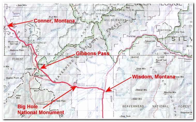 Route from Big Hole National Monument to Conner, Montana
In August 2002 after having finished the hike across the Big Hole Valley to Clark Canyon Dam I undertook the hike from the Big Hole Monument, over the Continental Divide and down to Conner, Montana, and my put in point on the Bitterroot River. I started by driving to Hamilton, Montana where I found a local willing to drive me back up to the Big Hole National Monument (6336 feet) the following day. We left Hamilton the next morning at about 10:00 and by 11:15 I was once again on hiking along side highway 43, but this time heading west. My route would follow the highway for about 10 miles to the turnoff for the dirt road that led up through the mountains to Gibbons Pass at the crest of the Divide and then down into the Sula River Valley and the headwaters of the Bitteroot River. From Sula the route followed Highway 93 northwest along the East fork of the Bitteroot River to the town of Conner, Montana where, in June, I had put in for the kayak trip down the Bitteroot to Lolo, Montana.
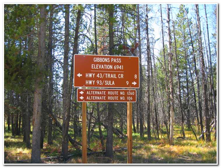
It was another warm sunny day and the 40 mile route promised to be a good work out, but I was excited about finally crossing the Continental Divide and connecting the East and West portions of my route. Shortly after leaving the western edge of the Big Hole I entered an alpine forest and closely following Trail Creek. Along the way the highway was paralleled by old stacked log snow fences that lent a sense of walking through history. Lewis and Clark had come this same way on their return trip in 1806, and the Nez Perce Indians were pursued along my route by Sherman in 1877 during the Nez Perce Indian War. By around 2:30 (mile 11, 6381 feet) I had reached the junction of Highway 43 and the Gibbons Pass Road. Trail Creek also branched off here and I continued to follow along it as I worked my deeper into the foothills leading up to the Pass. At about 2 ½ miles the track entered a narrows that wound its way through the mountains before emerging into a high open meadow at Hogans Cabin, an old homestead now used as a forest service guard station. Above Hogans the road once again contoured along through the hills as it rose slowly toward Gibbons Pass (6958 feet) which I reached at about 5:30 (mile 20) that afternoon.
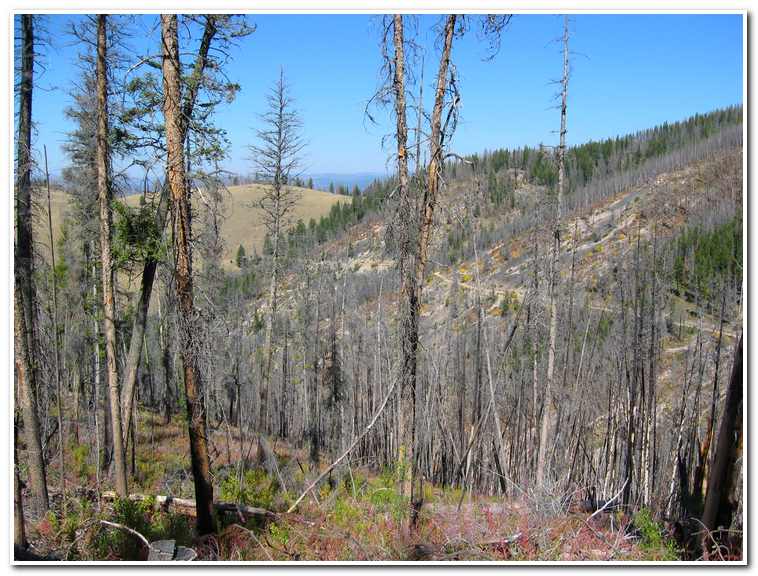
After resting for a while at the Pass I began the trip down the west side. Here the road closely contoured the hillside and I could look down into the Sula Valley about 2400 feet below. I hiked on for another hour and a half (23 miles) and then decided to make camp and the enjoy the last couple of hours of daylight reading a book and taking in the view of the high peaks of the Bitteroot Mountains, and Trapper Peak (10157 feet) to the West.
After a restless night camped on the rocky ground I had a quick breakfast (two breakfast bars and the rest of my water supply) and broke camp. I was on my way again by 6:30 and continued to follow the five mile descending contour toward Sula.
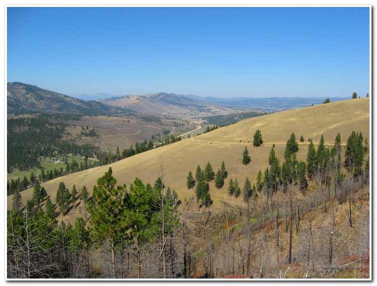
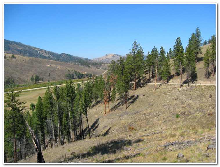
The road made for easy hiking and the scenery was pleasant, with Trapper Peak dominating the mountains to the west across the Sula Valley. The contour the road followed wound around and slowly down the eastern side of the valley through alternating open mountain grasslands and pine forests some of which still showed the destruction of the Bear Forest Fire of 2000. About 8:30 I reached the valley floor and hiked along between cattle farms north across the flat grasslands to a small road which then turned due west for a mile to the small crossroads at Sula (9:00; mile 5). By now the sun was fully up and the heat was beginning to build so I was grateful for the chance to take a break and refill my water supply and buy a little junk food for the remaining 12 mile hike down Highway 93 to Conner.
The Sula area, known as Ross’s Hole during the early 1800’s was where the Lewis and Clark party meet with friendly Salish (Flathead) Indians in early September 1805. Still in need of horses the expedition traded with the Salish for fresh mounts. Notable among the Indians’ herd were spotted horses, or appaloosa. The expedition left Ros’s Hole after two days and headed on down the Bitterroot Valley along the same route I was about to follow.
Today the route follow a somewhat less romantic path alongside Highway 93 which follows the course of the East Fork of the Bitterroot River through a narrow divide between Ross’s Hole and the northern portion of the Bitterroot Valley. This area too was heavily scared by the Bear Forest Fire, but is making a come back and the scenery alongside the busy highway is worthwhile especially when coupled with the history of the route. By a little after 12:30, a little foot weary and tired I walked into Conner (mile 40) and over to my put in point on the Bitterroot River. I had now connected the headwaters of the Missouri River with the “headwaters” of the Columbia River.
-

- Looking west from the entrance to the Big Hole National Monument.
-
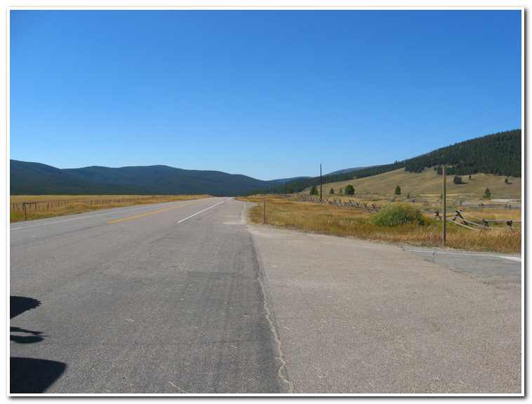
- Hiking along the Highway 43 west of the Big Hole Valley
-
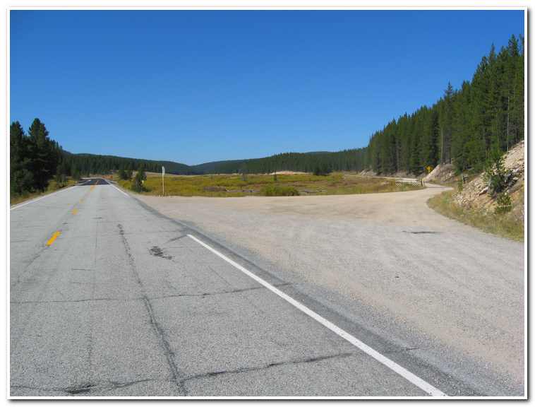
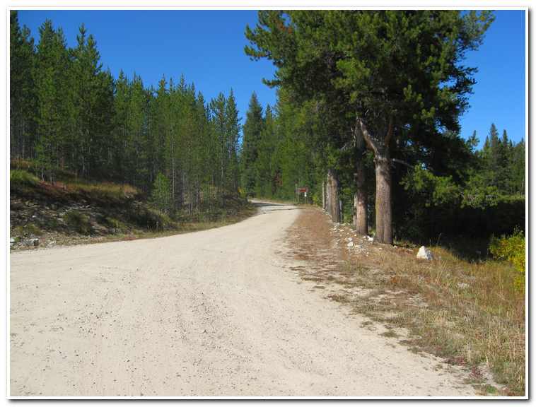
- Turn off to Forest Service Road 106 leading over Gibbons Pass
-
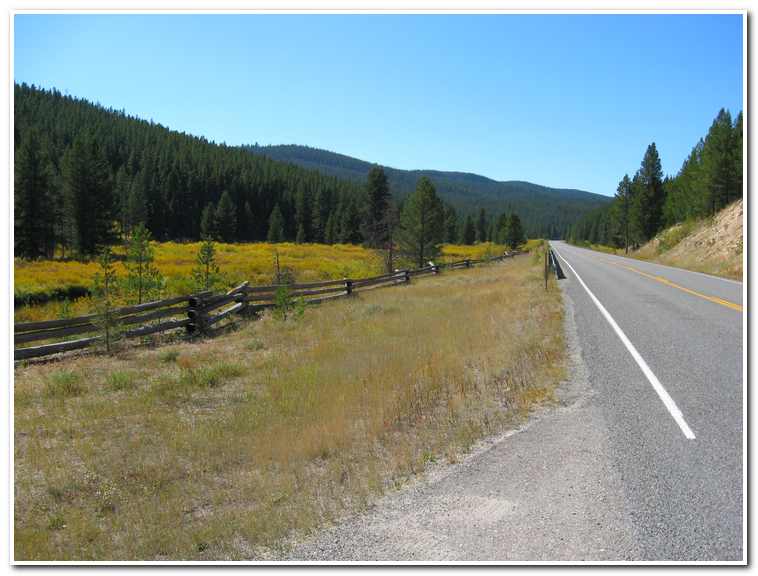
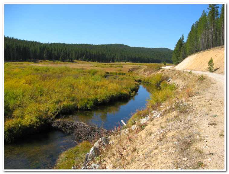
- Beaver Dam on Trail Creek near the start of the Gibbons Pass Road.
-
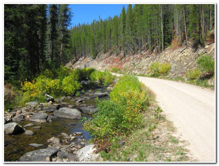
- The narrows before Hogans Cabin meadowland
-
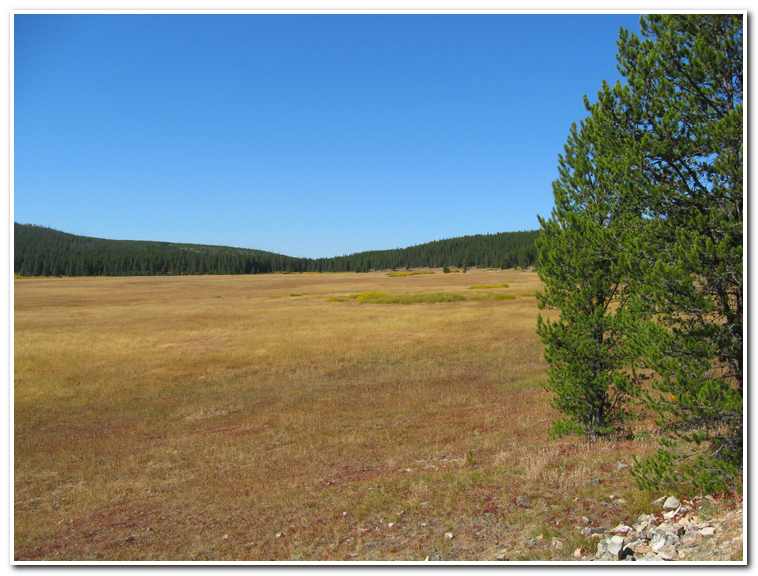
- Meadowland around Hogans Cabin below Gibbons Pass
-
- Nearing Gibbons Pass
-
- Gibbons Pass Summit
-
- Damage from the Bear Forest Fire of 2000
-
- Route leading toward Sula, in middle distance. Highway 93 in valley.
-
- Nearing the valley floor, near Sula.
-
- Cattle ranch near Sula, Montana

-
- Modern day Sula, Montana

-
- Hiking through the narrows between Sula and Conner, Montana

-
- Sawmill near Conner, Montana

-
- Put in on the Bitterroot River at Conner, Montana

Pages: « Previous 1 2 3 4 5