


The Glacier Haute Route Hike
Chamonix to Zermatt June/July 2010
Circa: 200KM – 125 miles
Steve Trafton, Katherine Lawrence and Al Errington
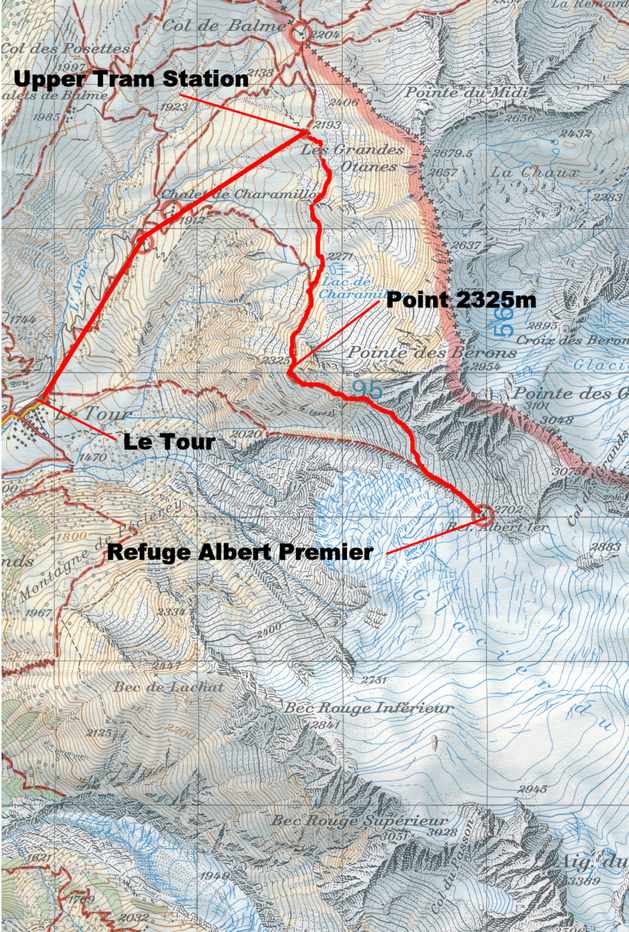
6/28 Stage 1: Le Tour – Refuge Albert Premier
This self-guided Glacier Haute Route hike follows three Americans from Chamonix to Zermatt, a distance of about 200km or 125 miles Circa: 200KM – 125 miles. Katherine and I flew to Geneva on the 27th and then took the train to Martigny and transferred to the little local train that goes over the Col des Montets and down into the Chamonix Valley. From the Chamonix station we walked through town to our hotel near the Aiguille de Midi tram station and met Al. We spent the afternoon sorting and repacking our gear and then walked around town taking in the sites and reminiscing about how one year before we were in the same spot preparing for our Tour de Mont Blanc hike.
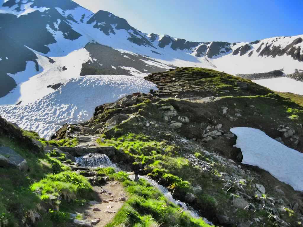
6/28 We got up at 6:30a and had breakfast at the hotel before walking up to the bus stop above the town square where we caught the bus to Le Tour and the start of our trip. After a short wait we caught the chair lift to the Col de Balme station (2193m – 7194ft) (9:30a). Here the hiking began. A good trail led easily south and climbed gently and crossed several small snowfields before rounding a prominent corner and turning south east and descending to a large snowfield which we crossed to gain the lateral moraine of the Glacier du Tour. Once on the moraine we climbed steadily at a moderate angle to the top of the moraine and then up a steep snow slope to the Refuge Albert Premier (2702m – 8865ft) (1:25p). King Albert opened the first rendition of this hut in 1930 to mark the centenary of Belgium independence.
-

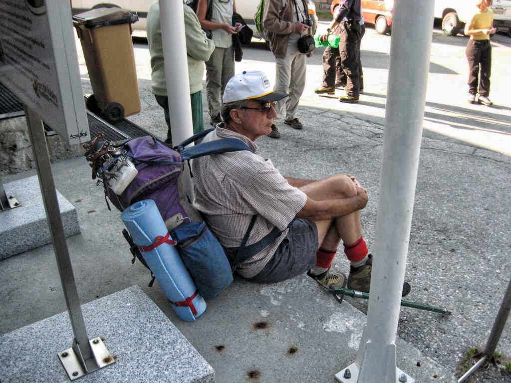
- Al at the bottom station of the La Balme tram at Le Tour
-
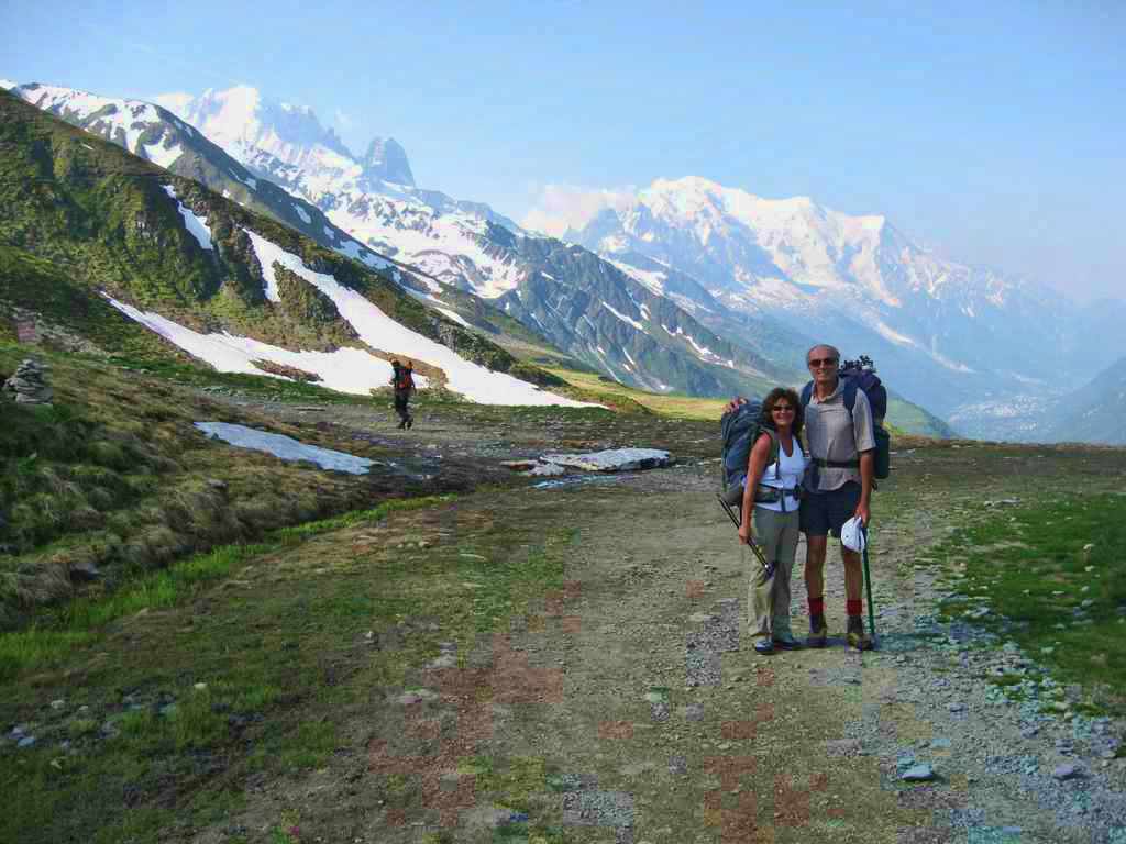
- Al and Katherine at the start of the route at the top station of the La Balme tram
-
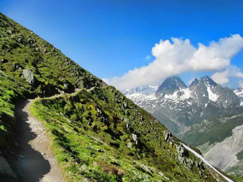
- The trail above the La Balme top station
-
- Stream crossing on the trail to the Refuge Albert Premier
-
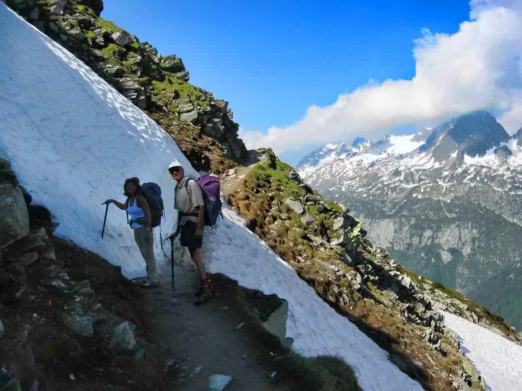
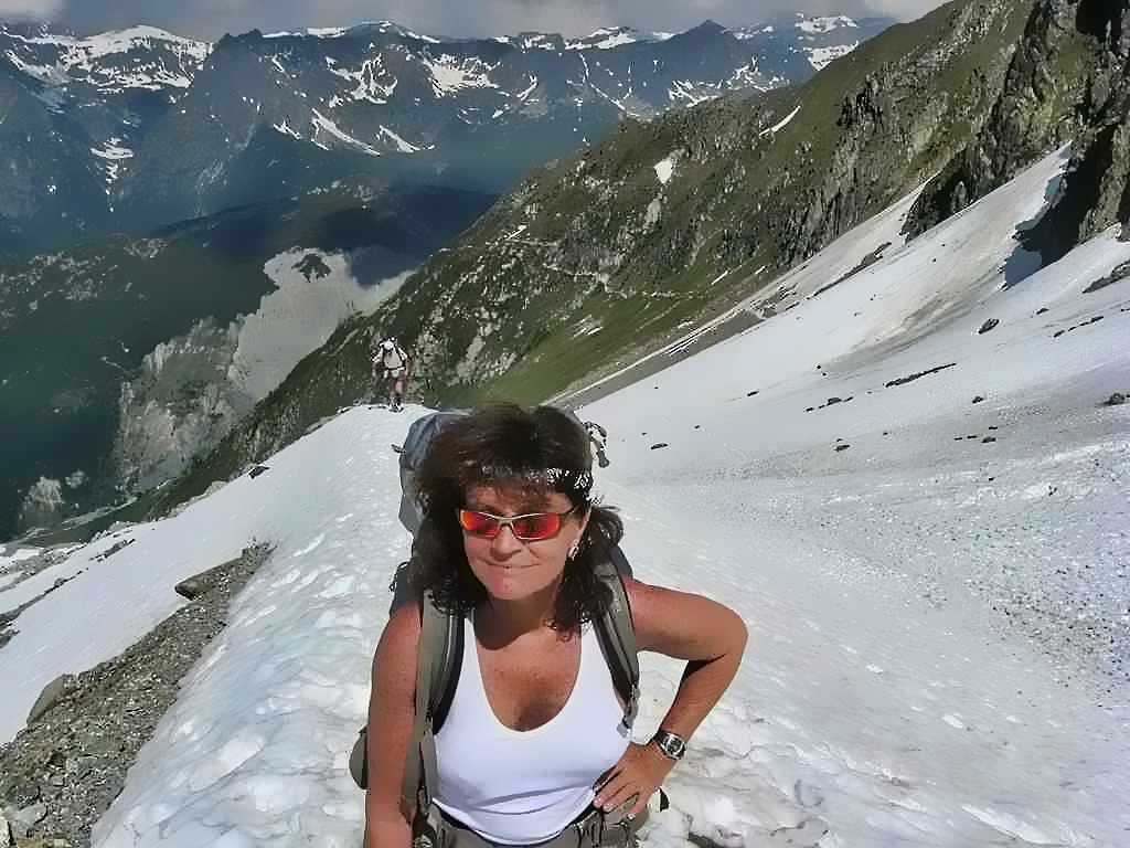
- Al and Katherine at a small snowfield crossing
-
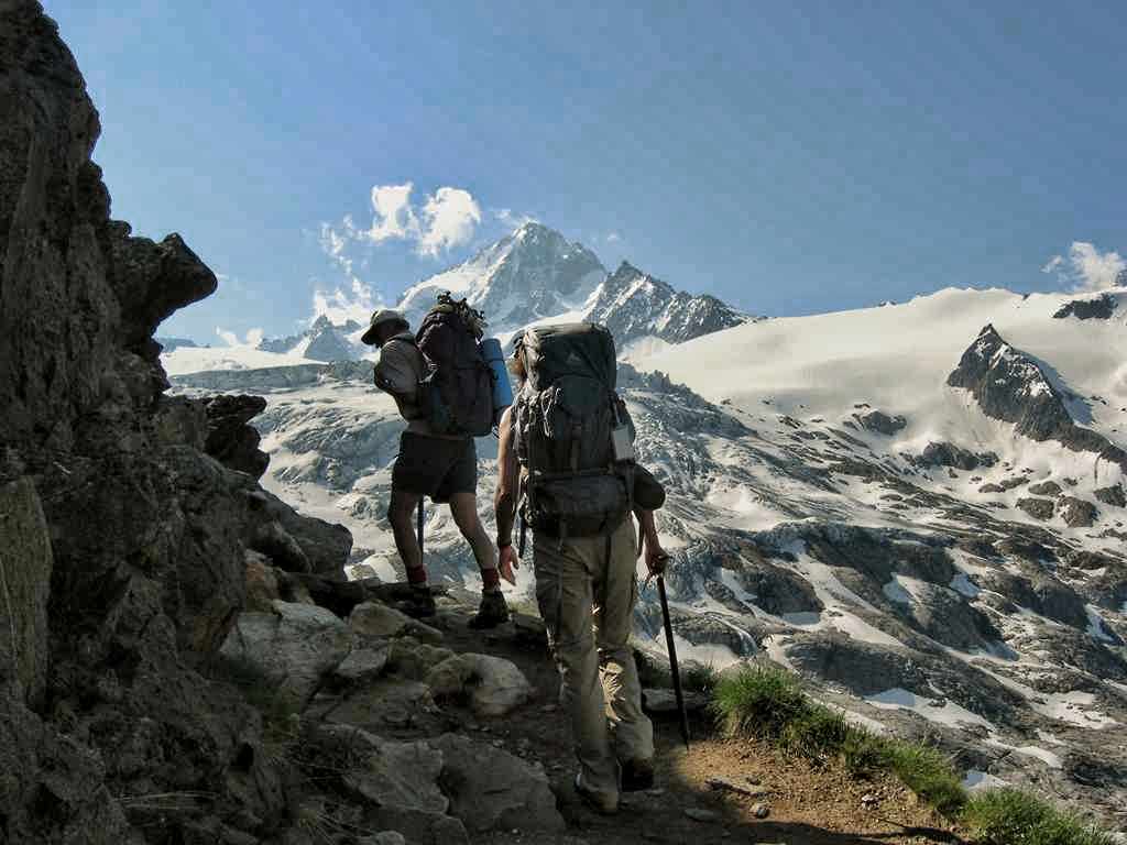
- Glacier du Tour (foreground), Aiugille du Chardonnet (background)
-
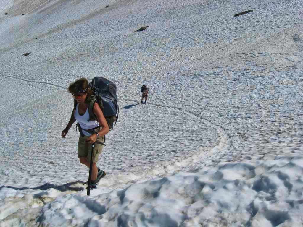
- Descending to gain the snowfields at the edge of the Glacier du Tour

-
- Crossing the snowfields to gain the ridge leading to the Refuge Albert Premier
-
- On the moraine below the Refuge Albert Premier
-
- On the final slope nearing the Refuge Albert Premier

-
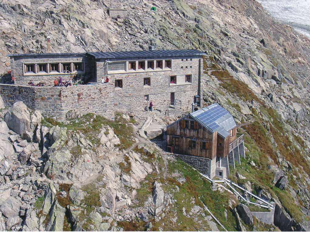
- Refuge Albert Premier
-
- On the patio of the Refuge Albert Premier
