Kayaking down the Bitterroot River
Conner to Lolo, Montana
76.5 miles
Section Two:
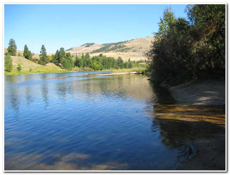
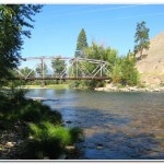
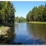
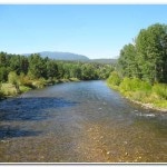
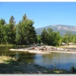
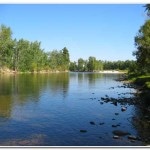
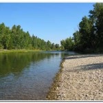
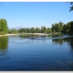
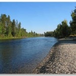
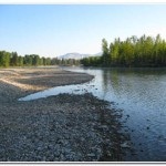
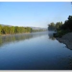
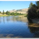
The Bitterroot Valley runs from south to north from Lost Trail Pass to Missoula, Montana. It is flanked on the east by the Sapphire Mountains and on the west by the Bitterroot Mountains. The Bitterroot River flows south to north through the valley and is known for trout throughout the western United States for its great trout fishing. It also offers a scenic kayak route connecting Conner, Montana in the south to Lolo, Montana, in the north. During most of the year this river is a gentle flowing shallow waterway, with an average flow rate of 900 – 1000 Cubic Feet/second, offering no real challenges or danger. But in May and June the Bitterroot swells to 9000 cubic feet/second, nearly nine times its normal size. During this period the Bitterroot overflows its banks and presents some real challenges to anyone trying to make the journey. Little did I suspect in mid June of 2002, when I decided to try kayaking down the Bitterroot River, what a harrowing experience it was to be.
On June 14th 2002, during the height of the spring runoff I drove from Seattle to Darby, Montana and settled into a rundown old motel. While at dinner in one of small diners in Darby I struck up a conversation with one of the locals who inquired as to why I had come to Dar by. I told him that I was working my way across the United States by water and hiking and then told him I was planning on kayaking the 71 miles down the Bitterroot to Lolo, Montana over the next two days. His response was immediate, “Are you crazy? Can’t be done this time of year. The water is too high.” Over the years I had learned to take what “the locals” had to say with a grain of salt. They often have an overblown sense of machismo about their little piece of the world, so I replied with my own bravado “that so?” The race was on. He talked about the many drownings over the years along the Bitterroot and I talked about me years in the mountains. Eventually I got him to agree to help by shuttling my car, the next morning after breakfast, from Conner to Anglers Roast. This first 22 mile section of the river would give me a chance test the conditions and set the stage for completing the additional 50 miles to Lolo the next day.
After breakfast on the morning of the 15th we drove to Conner and then west about a ½ mile to the put in site on the west fork of the Bitterroot. This is near the site that Clark and his contingent camped at on July 4the 1806 on their return trip. The water was indeed high and the current was four to five miles an hour, but it wasn’t too intimidating and so after a few minutes of preparation I pushed off and started down the river (10:30).
The river followed a narrow course through the woods and while the water threatened to overflow the banks there were only a few places where that had happened. About a mile downstream I rounded a bend and had to paddle hard to avoid a tree that had fallen over along the riverbank. This didn’t really create much of a problem, but was a sharp reminder to stay alert. Between the current and the sharp river bends there wasn’t too much time for reaction to obstacles and the consequences to becoming trapped by one of these “sweepers” would be very unpleasant. A little past the 2.4 mile mark the west fork meet with the east fork of the river and formed a considerably larger river with more obstacles to deal with, small rapids, logs, gravel bars and flooding outside the banks soon became the norm and held my undivided attention for the remainder of the trip.
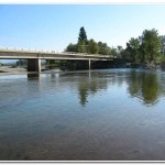
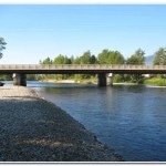
Four miles from the start I swept past the Hannon Memorial picnic area and then under the Highway 93 bridge. Once past the bridge the river valley opened up and the river broadened out. Here the river a gentle series of braided meandering turns as it a broad flat plan. The only real issue here was avoiding log jams. This wasn’t too hard since there was plenty of visual distance to give enough time to react and steer a course through the maze without getting too close to these dangerous obstacles.
About three miles down from the Highway 93 Bridge the river made a very sharp 100 degree bend and the entire bottom on both sides was flooded. Here the river literally ran through the woods. With the high volume of water moving down the river channel the bend was a torrent of surging water and boulders. I decided to cut the corner and soon myself navigating through the woods on an ad hoc joy ride amongst the cottonwoods and willows. As rough as it was I felt safer than trying to ride out of the class IV or V rapids of the main channel.
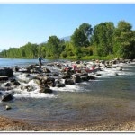
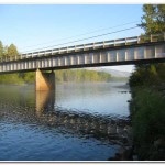
The next half mile or so was a strip of fast water and boulders making for a wet ride but nothing more than class II rapids. After that the river again broadened and straightened out considerably making for a little time to relax and enjoy the views before an exciting passage under the Darby Bridge (Mile 6.5; 11:45). I had about 3 feet of clearance under the bridge and had to bend forward over the deck of my kayak to clear! After the Darby Bridge I made an uneventful passage around Darby I thought most of the serious problems were behind me. I was wrong!
At about mile 10 the river became very braided and the main channel was hard to follow. I had to pick the most likely channel without being able to see whether it was the best route. Most of the time it was, but more than once channels were blocked by logjams and I had to paddle furiously against the current to get to shore portage around these hazards. Looking back on the experience I think I was very lucky not to have gotten trapped and swept under one of these killers.
After the excitement of the logjams downstream from Darby I again entered a relatively easy stretch of river for four mile to the Wally Crawford Bridge (mile 12.9; 12:45). The current was strong, and the river had overrun the banks but the there were no significant logjams and the main channel was easy to follow.
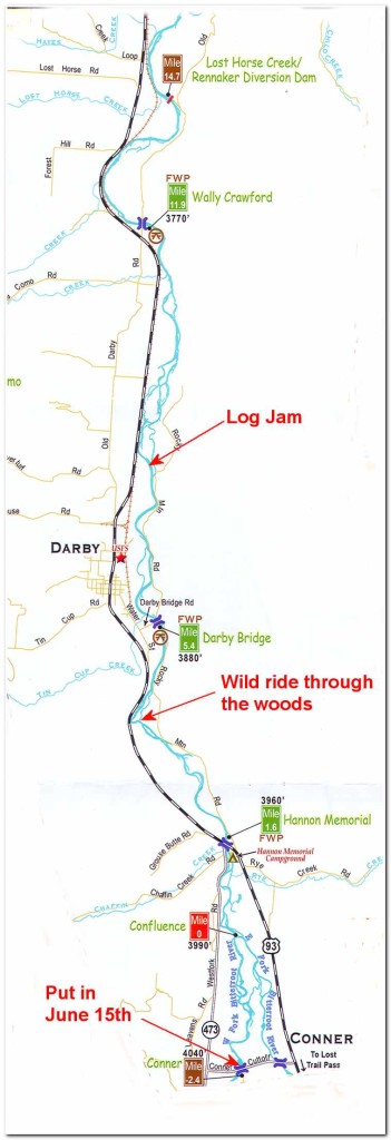
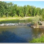
At mile 15.7 I came to the Lost Horse Creek/Rennaker Diversion Dam. There are six diversion dams on the Bitterroot and each one has to be carefully scouted and either portaged or carefully run, depending on conditions. With the water level so high I was nervous about these dams and as I approached this first one I landed about 100 yards upstream and hiked along the river bank so I could get a close up view of the possible route over the dam. Because of the high water it looked as though it was possible to make and very fast but safe passage. I committed the route a approach to memory and headed back upstream to my kayak and shoved off hoping I hadn’t committed too deeply. As I approached the dam I thought about changing my mind, but it was too late so I paddled hard took aim at the slot along the left bank that offered to best chance of success. I shot over the dam was quickly sluiced out the downstream side into the calmer water below. It was an exhilarating ride and at the limit of my ability. The standing wave at the bottom of the dam also made it a wet passage and one to remember.
After my ride over the dam I had about 4 miles of easy paddling across fairly open terrain till I reached the Sleeping Child Diversion Dam (mile 19.6; 2:00). Once again I stopped about 100 yards upstream of the dam and scouted the route ahead. This time I found the dam impassable, full of logs and tree stumps. There was no safe way to ‘run’ this dam so I returned to my kayak and portaged around the dam before putting in again about 30 yards downstream.
The next three miles downstream were uneventful with only a few logjams to avoid and at about 3:00 I crossed under Highway 93 once again and pulled into Anglers Roost (mile 22.6), a combination campground and rustic motel beside the river. I decided to stop for the day rest after the adrenalin inducing day I had had dodging logjams and passing dams. I rented a room and enjoyed a refreshing shower before downing three or four beers and having a fresh trout dinner. I took an after dinner hike along the river for a few miles to scout out route and further calm down before returning to my room and “rustic” accommodation of the Anglers Roost.
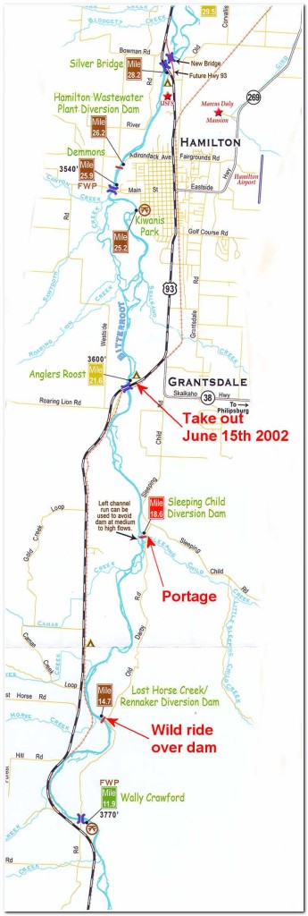
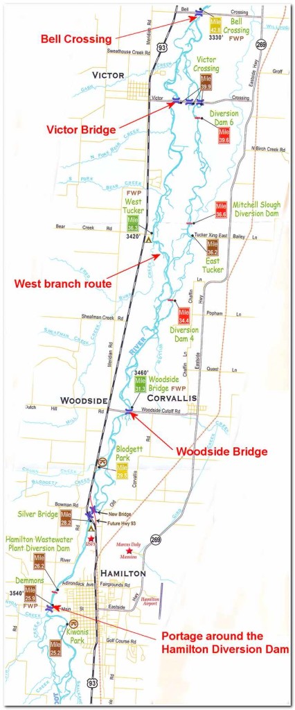
On the morning of the 16th I enjoyed “ranchers” breakfast of steak and eggs and made an early start (7:00). The final 50 miles of river promised to be a little easier and I had hopes of completing it in one day. I figured that at an average of six miles an hour I ought to be able to finish by one or two o’clock that afternoon. I push off from shore and began an easy passage toward Hamilton, Montana. At about 3.5miles I reached the outskirts of town where the river made a sharp right hand bend past the Kiwanis Park and then a sharp left just before passing under the Main Street Bridge. A short distance latter I came to the first obstacle in the route, the Hamilton Waster Plant Diversion Dam (mile 28.2; 7:45). Given the extremely high water and the drop over the dam I thought it would be the better part of valor to land and portage around. I’m glad I did. As I carried my kayak around the dam one of the locals told me that an unwary kayaker had drown here the week before.
After the portage it was smooth going past Hamilton and under the Silver Bridge (Highway 93) and the New Bridge (mile 29.2). Shortly after that the river braided into several likely paths. I choose one and passed several small log jams, gravel bars and class 2 rapids and soon passed under the Woodside Bridge (mile 32.8; 8:45). Ahead the river was slower moving and about 3 miles past the Woodside Bridge it split into an east and west channel. The east channel promised to lead me over several dangerous diversion dams so I choose the west channel. This proved to a good decision and the river continued to flow easily along at about 5 ½ miles an hour and presented few serious obstructions to be dodged. I made good time on this section of the river and at 10:15 I came to Victor Crossing (mile 42.3).
The small community of victor was named after the head chief of Salish Indians from 1842 until 1870. While his Indian name was Little Bear Claw the Jesuit priests of St. Mary’s mission gave him the Christian name of Victor. The Victor post office was opened in 1881.
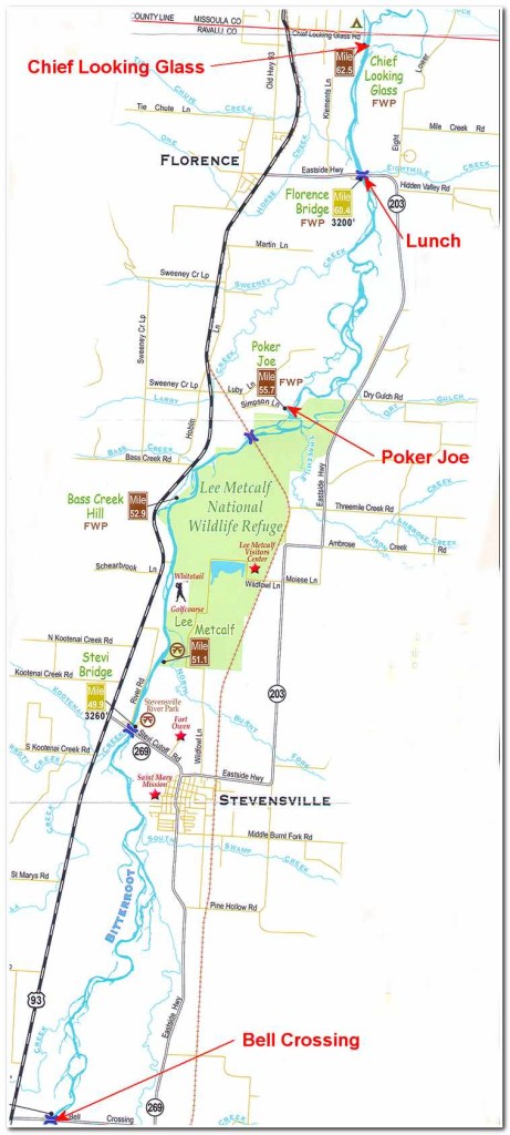
From Victor crossing it was another three miles of paddling fast, but easy water to Bell Crossing (mile 45.2). I put shore here and took a brief break for food and water before continuing on to Stevensville.(mile 51).
Stevensville was named after Isaac Ingalls Stevens, the first governor of the Washington Territory. He stopped at nearby Fort Owen in 1853, en route to his new post in Olympia. General Stevens died in the Civil War, and the town was named in his honor when the post office was established in 1867.
Just past the town I passed under the Stevi Bridge just north of town and then past the Lee Metcalf National Wildlife Refuge along the east side of the river. This 1700 acre refuge is home to over species of resident and migratory birds. It is named after Lee Metcalf who represented the people of Montana in Congress from 1953 to 1978. The refuge also is the site of the “hanging tree” where “Whiskey Bill” Graves, a member of the notorious Plummer gang, reached the end of his rope at the hands of the Vigilantes in 1864. After passing the refuge I paddled to the Poker Joe fishing access site on the left bank (mile 57).
After a brief stop at Poker Joe and continued on in relatively calm waters to the Florence Bridge (mile 61.5; 1:30 pm), I took out at the Florence Bridge and sat along the river bank enjoying a junk food lunch of potato ships and Snickers bars and reviewed my maps for the route ahead. At 2:00 pm put back in and continued on my way.
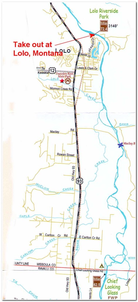
A little past the 63 mile mark I came to the Chief Looking Glass fishing access site. Chief Looking Glass was one of the leaders of some 800 “non treaty” Nez Perce Indians who fled northern Idaho in 1877. After evading a U.S. Army blockade in the Lolo valley they traveled up the Bitterroot valley and over into the Big Hole, where they fought off a surprise attack by 149 U.S. Army infantrymen and 34 civilian volunteers. They struggled on to the Bear Paw Mountains in north-central Montana, where Chief Joseph surrendered the 400 remaining Indians to Colonel Nelson Miles.
The last thirteen miles of the trip to Lolo were on mostly calm easy waters with rolling hills along the east side of the valley and higher mountains along the left. Finally after 51 miles of paddling that day I pulled into the take at Riverside Park in Lolo (mile 76.5; 4:30 pm)
Pages: « Previous 1 2 3 4 Next »


