Kayaking
Three Forks to Great Falls, Montana
246 miles
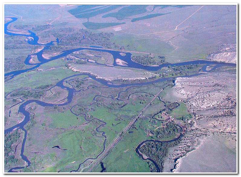
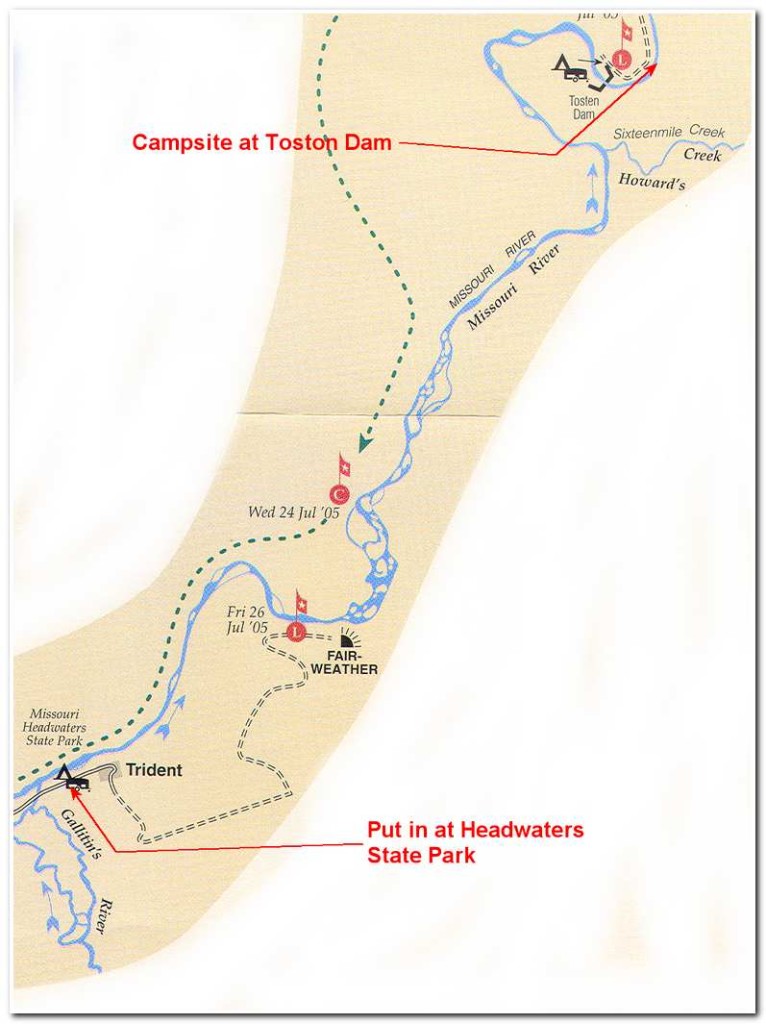
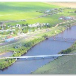
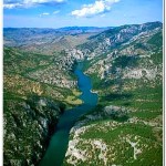
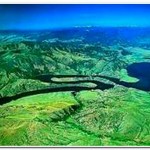
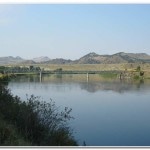
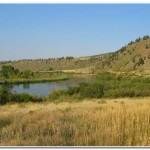
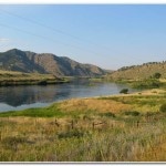
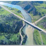
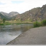
Three Forks, the Jefferson River (upper left corner) is joined by the Madison (upper left)
and then joined by the Gallatin to form the Missouri (upper right).
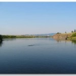
My put in site was just to the right of where the Gallatin flows into the Missouri
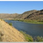
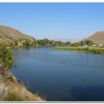
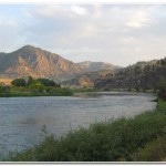
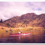
About five miles outside Three Forks, Montana, the Gallatin, Madison and Jefferson Rivers come together to form the headwaters of the Missouri River. Today that merger is marked by the Missouri Headwaters State Park and it also marks the spot where, on July 25th 2002 I began my journey along its course to St. Louis. But I started by kayaking the route from Three Forks to Great Falls, Montana. At the time, standing at my launch point on the river I couldn’t help but be a bit intimidated by the scope of the task I had set for myself. Over 2300 river miles lay between me and my goal at Arch in St. Louis. But, ‘if you’re not moving you’re standing still.’ These words that I had often used to exhort my companions in mountains I now turned on myself as I slid into my 12 foot kayak and shoved off.
From the launch point the river runs along the left hand side of a narrow valley with railroad tracks and rolling sage bush hills to the left and the dead end road to Trident on the right. After about ¾ of a mile I passed the Trident cement plant on the right. Immediately after that point the river passed through a little jog followed close to the hills on the right hand bank. After about four miles of pleasant paddling almost due north the river passed through several small rapids and turned sharply to the southeast. The current here was very swift and as I came around the bend and was surprised to find a small dam across the river. I didn’t have time to maneuver to the shore scout out the route and so was swept over the three foot high dam. I managed to stay upright and fortunately there were no logs and only one or two rocks on the lower side of the dam which I scraped over safely. This was a little more exciting then I had bargained for and I wondered what other uncharted obstacles might lay ahead. 2002 was a very low water year and I think that in ordinary times this dam is covered by enough water that it doesn’t present a significant obstacle to paddlers.
About a mile past the dam I pulled over to the right shoreline and stopped for a rest before continuing on for another 5 or 6 miles of calm braided water with modest cliffs on the left and open rolling hills to the right. As I paddled on a thunder storm gathered around me and soon the winds and rain came. I pulled over to the right shoreline again and pulled my kayak up on the beach and sat under some small trees while I waited for the storm to pass. The thunderstorms in Montana seem to come on very quickly and in the days to come I would find out the hard way just how dramatically and water condition can change. Fortunately after the storm passed the winds dropped off again and the river returned to its slow pristine persona.
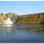
I continued on until the river entered a narrow slot and passed beneath an old abandoned railroad bridge at Sixteen Mile Creek and made a ninety degree turn to the left as it started around a big oxbow bend that would lead to Toston Dam. I passed a small island on the left and then worked around a sharp bend to the northeast. This area is known as the “Devil’s Bottom” and the locals told me that I was fortunate because high winds are funneled through this area and the water can be quite rough and dangerous. After twenty miles on the river I paddled through the calm waters of the small narrow lake backed up by the dam an soon reached the take out for the portage around the dam.
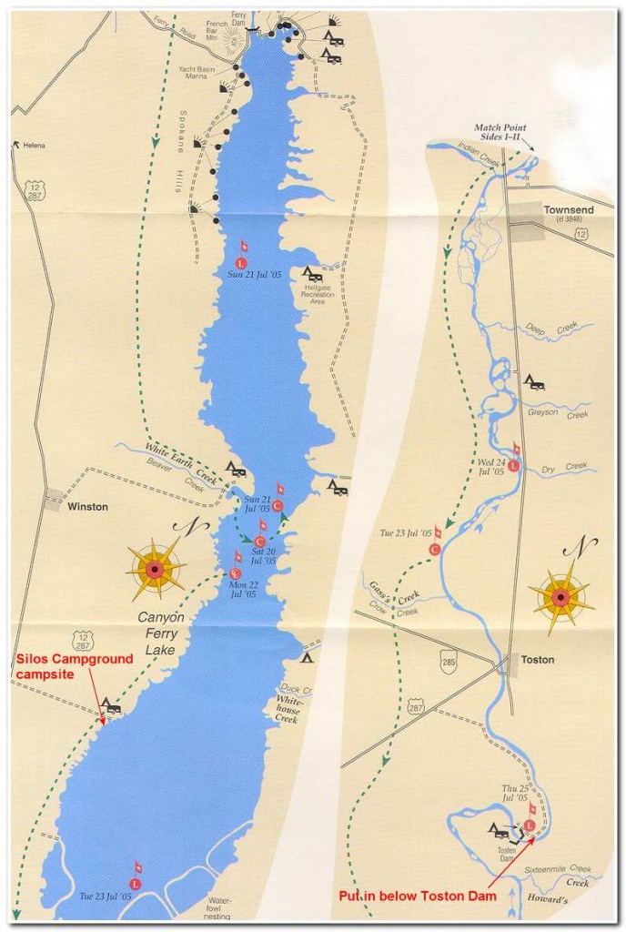
Shortly after I reached shore the campground host, Sonny Weldon asked if I needed a hand making the portage around the dam. I accepted gratefully and he drove me and my gear about a half mile down the road to the put in spot just below the dam. Since it was now about 5:30 I decided to pitch camp and spend the nigh here before continuing on to Canyon Ferry Lake some 22 miles further on. I had made 20 miles that first day in about five hours and felt that I was adjusting well to enduring long intervals of paddling.
The next morning (July 26th) I was up by 6:00 and, after a leisurely breakfast I was off 7:30. From my campsite the river bends sharply around to the northwest and passes through another deep slot in the hills before emerging a broader plain which leads to Canyon Ferry Lake. This first section had several swift, but easily handled stretches of fast water. A little further on I passed beneath two bridges and the small town of Toston (8:20; 3 ½ miles).
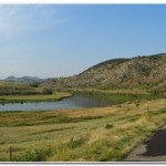
After passing Toston I continued in calm waters to the York Islands (10:00) at about 14 miles from the dam. Beyond the York Islands there were several areas of shallow water and some fast water and boulders where I had good exercise at ‘reading’ the river to navigate through. About 6 miles further downstream I passed under the highway 287 bridge and pulled into a take out spot near Townsend (11:25; 20 miles). I hide my kayak in some brush and walked a short distance (3/4 mile) into town for a hamburger and milk shake at the local drive in before returning to the river.
Once on the river again it was about 1 ½ miles to the delta leading into Canyon Ferry Lake. This delta was a test of my ability to read the river. As I worked my way through nearly a mile and a half of braided, shallow water with many false leads. By carefully watching the current I managed a circuitous path through this maze and emerged onto the lake. It was only after I had passed through the delta and had committed to the lake (23 miles) that I noticed a large thunderstorm quickly forming behind me. The smart thing to do would have been to retreat and paddle back into the delta and ride out the storm. It would have been wet but at least the waves and the chance of a capsize would have been minimal.
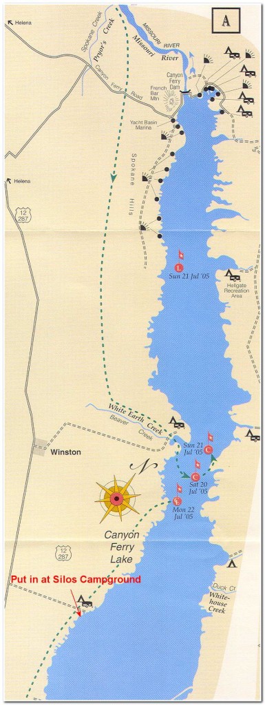
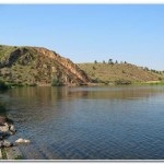
Well, there is the smart thing and then there is the thing I sometimes do; go for it! It is a 3 mile paddle from the end of the delta to the Silos Campground. There is no where to pull out before Silos. A steep, 1.8 mile long levee surrounds the “Duck Pond,” effectively closing off that shore for an emergency pullout in anything but the calmest waters. I started paddling as quickly as possible hoping to beat the storm, but it soon became obvious, that wasn’t going happen. After about ten minutes the wind started to come up and the waves began to build. I increased my stroke to a near sprint pace, but it wasn’t long before the wave began washing over the deck and the wind gusts made the kayak even more unstable. Another rule I broke was not putting the spray skirt on the boat before leaving Townsend so I was traveling in an open cockpit boat. I guess the good news was that a kayak half full of water seemed to have enough ballast that the wind couldn’t blow it over. I tried bailing out some of the water but the waves made that a fool’s errand. I struggled on, but even though my paddling tempo was something near a flamenco dancer’s, my forward progress was captured in slow motion. As Robert Service would have said “it wasn’t much fun” (see the Cremation of Sam MacGee).
After nearly a hour of this ordeal I managed to reach the shoreline at the Silos Campground (2:00; 27 miles). With considerable relief I was able, to once again stand on firm ground. Since the wind a rain continued to rage on I didn’t have time to savor my victory over the elements for long. I emptied the kayak of water and carried my boat and gear about a hundred yards inland to the closest available campsite and made a hasty camp so I could change into dry clothes and take a much needed rest.
After the storm passed I emerged from my shelter and walked a mile further inland to the Twin Silos tavern out on the main highway (287) and had couple of well deserved beers and an order of pork ribs before returning to my camp and spending the evening reading and contemplating the next day’s paddle up the lake.
Route of July 27th 2002
July 27th dawned calm, clear and sunny; a great day for paddling. I left camp at 7:00 and set off down the lake. I passed long the west shoreline of the lake, making good progress in fine conditions. By 9:00 I reached White Earth Campground (8 miles) and by 11:00 I was passing Cemetery Island (17 miles). At 11:30 I arrived at the Yacht Basin Marina (18 miles). The marina is about one mile from the Canyon Ferry Dam and is the take out for the portage around the dam. I took the opportunity to have lunch at the marina and then found a local who was happy to load my kayak in the back of his pick up truck and drive everything around to the put in site about a half mile below the dam.
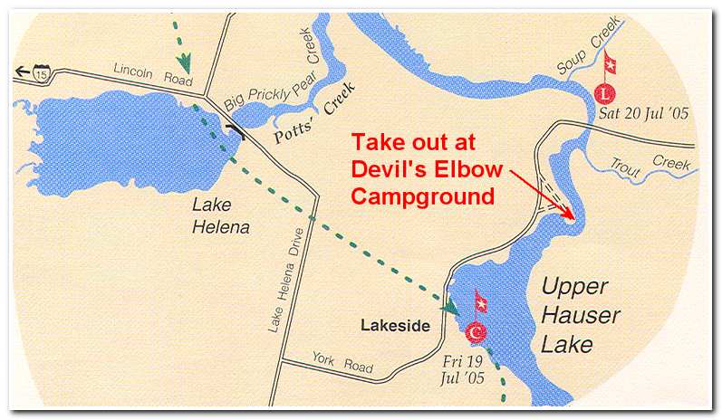
Once around the dam I reloaded the kayak and set off (1:15) through the narrow gorge that empties out into Upper Hauser Lake. However, before I could reach the lake another very sudden storm blew down the gorge. Thunder and lightning and hail forced me ashore where I sought refuge under some small trees while the storm passed through. Once back on the river again I made good progress out into the lake past the town of Lakeside. About two miles further on I came to Devil’s Elbow Campground (27 miles) where I pulled in to make camp. This had been a good day considering all the paddling was in lakes without any appreciable current to add to my speed. I was now 74 miles into my trip and feeling stronger each day.
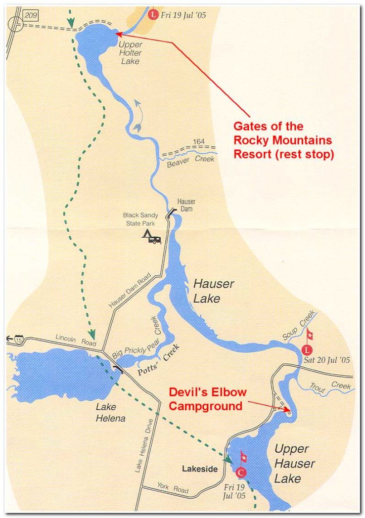
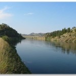
The next day (July 28th) I got an early, 6:55 start. About a mile after leaving the campground I passed under the York Bridge. After the bridge the river passes through another very narrow section with cliffs on both sides. This is a very pretty passage and continues for several miles before the river once again widens as it passes Prickly Pear Creek before narrowing again as it approaches Hauser Dam. I reached Hauser Dam (8 miles) at 9:00 and began carrying my gear and kayak about a ¼ mile around the dam to the put in below. By 9:30 I was on the river again passing through a very narrow gorge with several boulder strewn shallow passages. This is a spectacular three mile section with steep cliffs rising on both sides of the river. After passing through the gorge the river widened into Upper Holter Lake which soon led me to the Gates of the Mountains Marina (10:00: 14 miles). I stopped here for an hour’s rest before starting my passage of this famous spectacular five mile section of the river which leads through a gap in the mountains before emerging into a ten mile series of oxbows and finally into Holter Lake.
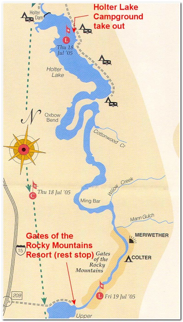
to Holter Lake Campground take out
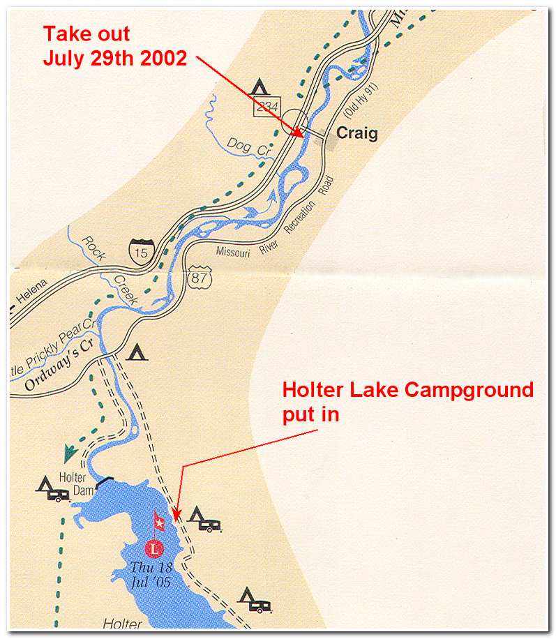
There was a lot of boat traffic passing through the Gates and I stayed along the right hand shoreline to avoid the wakes and be near shore in case the wind picked up and it was necessary to seek shelter. At noon I pulled into the Meriwether Recreation Area (18 miles) amid several large tour boats and walked around for about a half hour. Once again on the river, after about a mile I emerged out of the steep walled Gates and started around a series of giant oxbows. By now a fresh breeze was blowing I had some spray to contend with as I made my way around Ming Bar and into the Oxbow Bend. After passing around the bend I came out into Holter Lake (29 miles) and was met with a strong afternoon breeze and 3 foot wind waves. I made a touchy 1 ½ mile diagonal crossing of the lake and sought shelter at the Indian Trails Marina (30 ½ miles). I waited here for about an hour for the winds to calm a bit before continuing on down the lake to Holter Lake Campground (4:00; 34 miles). I was more than ready to stop and set up camp here after a long day of still water paddling, but I was really pumped up from the progress I had made on one of the most enjoyable I have ever made. After a good dinner at the Holter Lake Lodge I crawled into my tent and fell quickly into a deep sleep.
On the 29th I rose early and repacked my kayak for the short paddle to the take out across the lake on the west side of Holter Dam. From there is was a 0.4 mile portage down a service road to the put in about ¼ mile below the dam. Holter is the last of the dams until Great Falls. From here the river current aided in the paddling and my river speed picked up considerably. Immediately below the dam the river followed a path through the last of the foothills before emerging out into rolling shallow hills as it worked its way toward Great Falls some 90 miles further along. I soon passed under the Wolf Creek Bridge and not along after pasted by Rock Creek on the left. The river was now sandwiched between Highway 87 on the east and Interstate 15 on the west as it meandered north for five miles to the town of Craig.
I had now traveled a total of 116 miles from my starting point at the Headwaters Park near Three Forks. I had experienced swift water, wind, thunder storms, hail, an unexpected dams and portages around the major dams of the upper Missouri River. It was with a sense accomplishment that I unpacked the kayak for the last time, strapped it on my SUV and began the long drive back to Whidbey Island. I would return a few weeks latter undertake to complete my route to Fort Benton some 130 miles downriver.
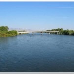
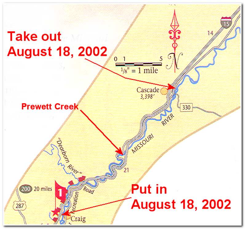
On the morning of August 18th 2002 James McCusker and I arrived in Craig and set out for Great Falls. James was a long time friend and had expressed an interest in coming along. It was great to have someone else as enthusiastic as I was to be on the river since this section of river was relatively tranquil I felt comfortable in taking him with me. We unloaded our kayaks at the ramp in Craig stowed all our gear and paddled off at 8:30 that morning. The sun was out and the paddling was idyllic. We paddled easily and in the couple of miles passed under the first of several bridges that carry Interstate 15 over the river. From there we followed a gentle course alongside the roadway to Dearborn Ramp (5 ½ miles) where the highway again crossed over the river.
The next 10 miles of river is a series of nine oxbow bends that traverse through a gap in a small range of narrow mountains between the Dearborn River and Prewett Creek. Even though the interstate followed the course of the river and was never far away these oxbows were very scenic and Jim and I were both struck by the sense of travel through a book where each page, or bend in the river, revealed a new scene as we made our way through the mountains. It was an idyllic paddle with no serious fast water and we often just floated our way along letting the river do the work. After several hours we came to Prewett Creek (16 miles: 12:15) where we stopped for a rest and walked a short distance to Osterman’s Missouri River Inn and had lunch.
After lunch we put in once again and started off down the river toward “Halfbreed Rapids.” These rapids are the only real white water between Holter Dam and Great Falls and required some care in navigating. As we entered the rapids we passed under the last of the Interstate 15 bridges and then immediately had to avoid a low-lying, car-sized boulder and then had to read a paddle our way through some class 2 and class 3 rapids which continued on for nearly a half mile from the bridge. The passage wasn’t death defying but it was a good challenge after the easy class 1 and class 2 water I had experienced since leaving Three Forks.
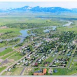
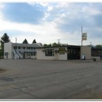
We reached Pelican Point Campground (20 miles; 2:00) and pulled out here for another rest stop before continuing on for the town of Cascade. The current between Pelican Point and Cascade pretty swift and so even though there were no real trouble spots we made it to the outskirts of Cascade in less than an hour and a half (28 miles; 4:15), about 5 1/3 mph average speed. We passed under the Cascade Bridge and stayed left entering a calm off river channel that passed by several houses on the riverbank. At one of houses we pulled ashore and asked the owner for permission to pull out and store our kayaks overnight. The owner turned out to be Terry Curnow, who along with his wife Pam arranged for our accommodation. It turned out that they have many kayakers that stop by and they were always glad to host paddlers both at their home and at the motel they owned (Badger Motel and Laundromat) a short distance in town. Terry was also a maker of wooden kayaks and spent time giving us a tour of his shop. After talking with Terry and Pam, James and I walked into to the motel and settled in for a well deserved rest.
-
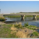
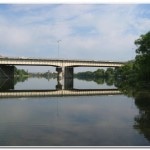
- Muddy water from the Dearborn River enters the Missouri Muddy water from the Dearborn River enters the Missouri underneath the Interstate 15 Bridge twenty miles above the town of Cascade, Montana.
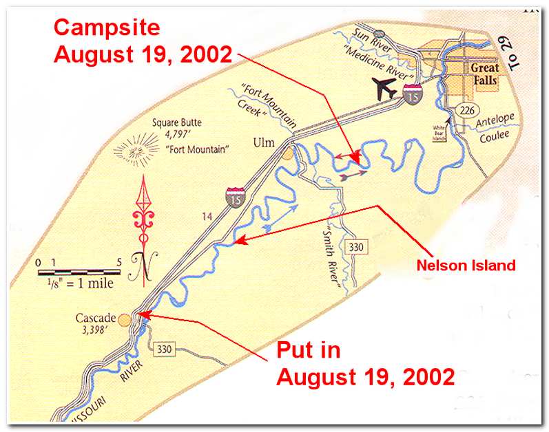
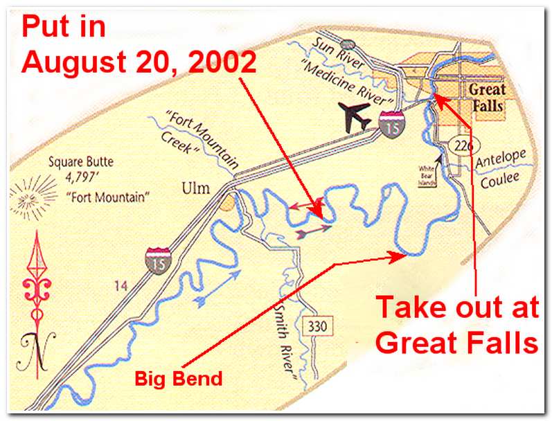
On the 19th we got up at 7:00 and had a quick breakfast before returning to the kayaks and shoved off at 8:15. Between Cascade and Great Falls the river slows considerably all around the river bottoms. There was a ten to fifteen mph breeze so depending we each time the river changed direction we were either heading into the wind or away from it (we preferred the ‘away from it direction’). For a better appreciation of just winding the river is in this 50 mile section, we paddled 2 river miles for every 1’ as-the-crow-flies’ mile. At 10:20 we passed by a group of weekend cottages at Riverdale and rounded Nelson Island in the right hand channel. Finally, after seven hours we reached the town of Ulm and stopped for a rest and something to drink. It was very hot and we were pretty worn out after making the 27 mile paddle. Our average speed had dropped to 3.8 mph. Since there wasn’t a good place stay in Ulm we decided to continue on look for a suitable camp campsite on the river for the night. We left at 4:15 and 454 minutes before spotting an island in the middle of river that looked inviting (32 miles; 5:00). We pulled ashore and set up a pleasant camp where we had great views, not only of the river, but also of the stars and a full moon that night.
After good nights sleep we got up at 6:00 and had breakfast, loaded the kayaks and shoved off at 7:00 for the last 24 mile stretch of river into Great Falls. Fortunately the river picks up speed a little as it passes through a moderately narrow valley between high hills on either side which extend to Great Falls. For the first hour we passed through several bends in the river to the south of Antelope Butte. The river then swept through a sharp bend (9 miles: 9:10), dotted with houses on the right and almost due north past Buckshot Island before turned very sharply back due south and around Big Bend (14 miles; 11:00). As we rounded Big Bend we turned north and left side of the river became sandy and shallow so we stayed to the right hand side and turned Fisher Island on the right side of the river before entering a narrow section of river soon led to the outskirts of Great Falls and a great deal of river traffic. By 1:15 we were at Park Island, just south of the highway 89 bridge across the river (22 miles). With our goal now in sight we paddled under bridge and then to the right hand shore and to the pull out at the Portage Ramp (24 miles: 1:50).


