Stage 4: Gruben-Meiden – Augstbordpass – St. Niklaus
7/17 The trail to the Augstbordpass started on the south side of the Hotel Schwarzhorn in Gruben-Meiden, where we spent the night. It led uphill over a grassy pasture and then through a wooded section of larch and pine. After about 35 minutes we came to a trail junction at Gruobualp (2150m – 7055ft) (7:50a). From here the path passed to the right side of the huts and headed uphill to the left of a stream in the hanging valley of Gruobtalli. The trail continued to rise to a lumpy inner region of the valley with scree slopes lining the southern wall of peaks, and grassy hummocks elsewhere littered with grey-green lichened rocks. Shortly before 8:30a we hiked up over a rocky step, then descended slightly to go around a small pond before rising again, this time at a steady incline on the final stretch to the Augstbordpass (2894m – 9494ft) (9:00a).
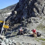
We took our packs off, had a victory cigar and rested, enjoying the view out over the Inners Talli valley, east of the pass, and the Fletschhorn (3918m – 12,854ft). A clear path led down from the pass in switch backs to a rocky bowl on the eastern side of the cirque that holds the Inners Talli. After the first steep section the path eased its descent and about twenty minutes from the pass we passed through a narrow rocky cleft and emerged into a rock and grass alp. In a few more minutes we came to a trail junction and took the Jungen/St. Niklaus option that sloped down and then hugged the right hand side of the valley, crossing over the Embdbach stream.
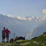
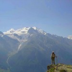
The route then started a gently rising traverse of the southern flank of the valley heading east across a slope of boulders and rocks. We continued the traverse until we reached the shoulder of a small mountain (2487m – 8160ft) where we could look down into the deep cut of the Mattertal. Continuing on round the shoulder the path narrowed and rose steadily, climbing several rocky steps and turned a ridge at Troura (2656m – 8714ft) (11:05a). Here we were treated to one of the best views of the entire stage of the trip. Across the Mattertal soared the Nadelhorn, Lenzspitze, and the Dom, with the Reid glacier pouring into a narrow gorge above the village of Grachen. To the right, at the head of the Mattertal, Liskamm, Castor and Pollux and the long white block of the Breithorn, with the small pyramid of the Kleine Matterhorn completed the panorama. After just a few more paces the Weisshorn exploded into view.
In a short distance the path became a paved track which wound down, in wide loops until Untere Lager (2254m – 7395ft), a prominent trail junction was reached. We took the trail marked to Jungen Rundweg which wound down through boulder strewn forest eventually reaching Jungen (1954m – 6410ft), a pleasant alp hamlet perched on the hillside high above the Mattertal and the town of St. Niklaus. Jungen provided, not only a chance to rehydrate with the local beer, but also to enjoy the great views down the Mattertal while sitting on the patio of the little family run restaurant trailside near the church. The last bit of trail led below the restaurant and zigzagged into the forest below the village. After about a half an hour we came to a junction where we continued straight ahead and crossed a rocky cleft on a footbridge over a wild stream. The trail continued down through forest and pastureland and eventually emerged near the St. Nicklaus train station (1226m – 3695ft), some 5800 feet below the Augstbordpass.
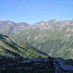
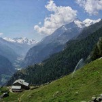
- Looking back toward the Pas de Forchetta and into the Gruben-Meiden valley
- Rest stop at the Augstbordpass
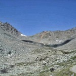
- Looking up toward the Augstbordpass from the Inners Talli valley
- Dwight and Byron at Troura
- The Dom from Troura
- The mountains of Zermatt in the distance and the Weisshorn on the right

