


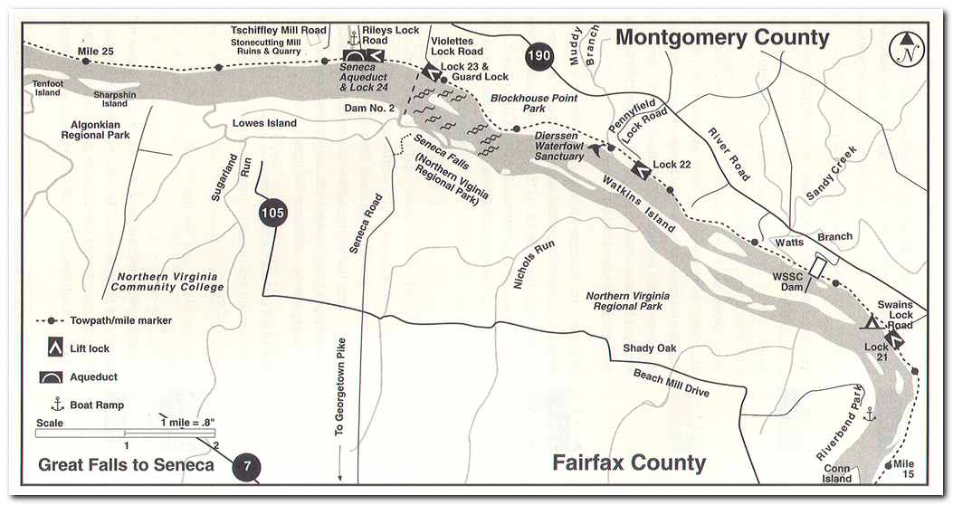
From Lock #23 the trail continues to follow the Potomac past the Seneca Creek Aqueduct and Lock #24 (milepost 22.7). Here the towpath turns the distinctive red shade of the Seneca sandstone that was used as roadbed material.
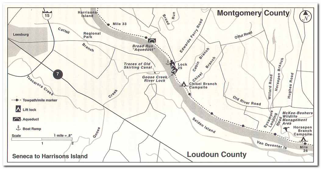
At milepost 27.2 I started through the McKee-Besher Wildlife Management Area a 300 acre preserve which many local birdwatchers enjoy throughout the year. At mile 30.6 I came to Goose Creek River Locks. These locks admitted boats from the Potomac River and from Goose Creek on the opposite Virginia shore. These “river locks.” One opposite the Shenandoah River at Harpers Ferry and one opposite Shepherdstown and the one at Goose Creek, were demanded by the Virginia Legislature of 1833 to provide a market for Virginia products in return for the purchase C and O Canal stock. At milepost 30.9 I walked past Edwards Ferry. In October 1861, Union troops crossed the river here in a supporting action to the crossing upstream at Whites Ferry (milepost 35.5) during the battle of Balls Bluff. After the battle of Chancellorsville, the Union army built a pontoon bridge across the river here, anticipating that they might have to cross the Potomac from Leesburg to follow the Confederate army north. The crossing did come to pass on June 25 and 26, 1863 after it was learned that Lee was moving up the Shenandoah Valley to invade Maryland and Pennsylvania. Two weeks later the armies would meet at Gettysburg.
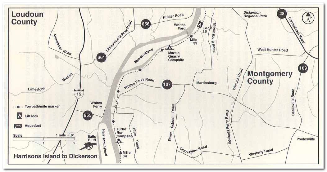
After passing Edwards Ferry it was another hour long hike to reach the Whites Ferry (milepost 35.5). Whites Ferry is the only active ferry still remaining along the Potomac. The ferry has been in operation since 1817 when it was originally known as “Conrad’s Ferry”. In 1871 Elijah White, a former confederate officer bought the ferry and named it the General Jubal Early in honor of his former commander. I took the ferry across and walked into Leesburg where I explored the town and then spent the night after a short day.
Pages: « Previous 1 2 3 4 5 6 7 8 9 10 11 12 13 14 15 16 17 18 19 20 21 Next »