Black Horse Racing Header

“If you’re not moving, you’re standing  still.”


Steve Trafton

Fall in Colorado 2022

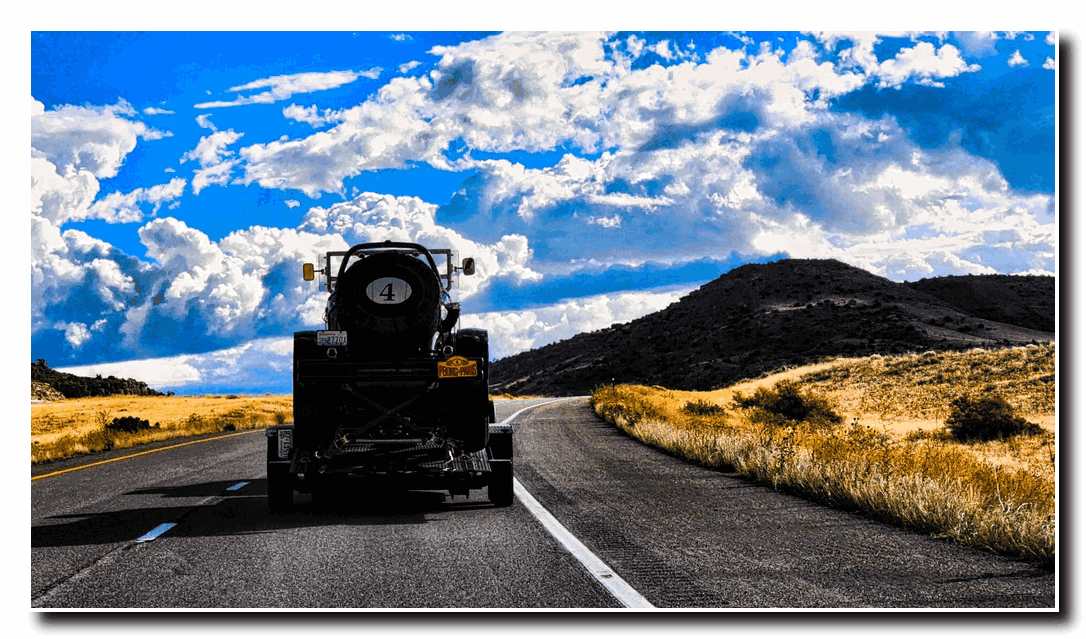
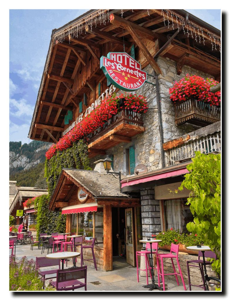
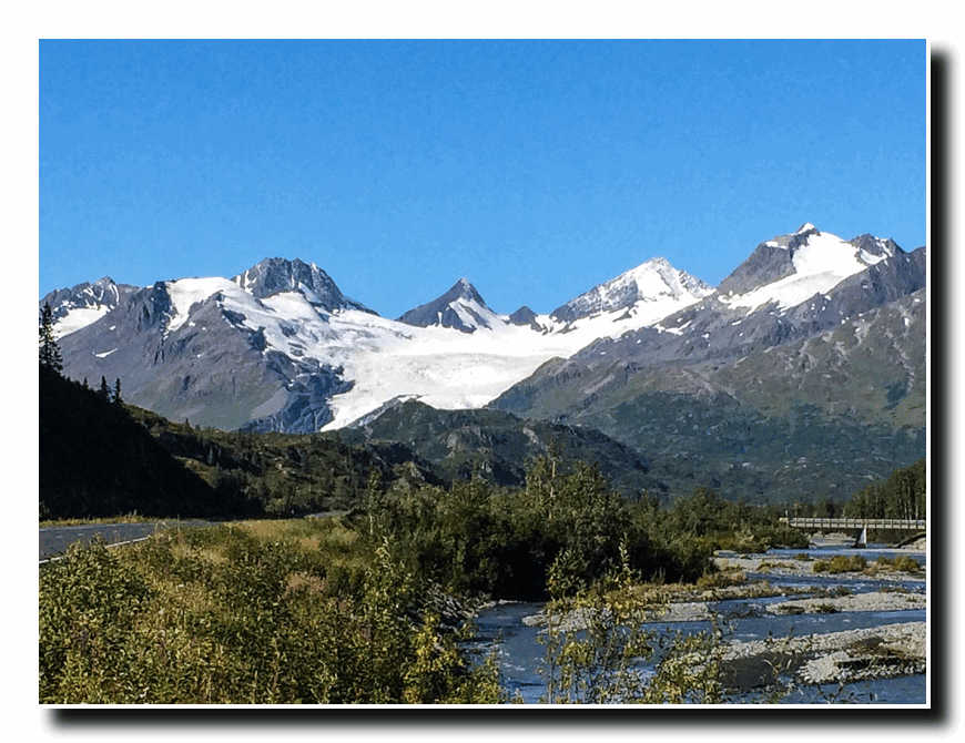
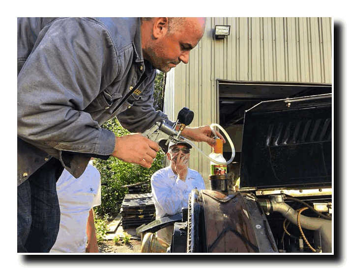
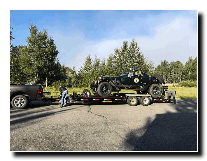
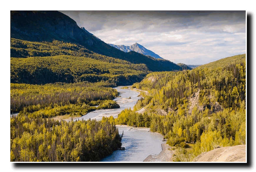
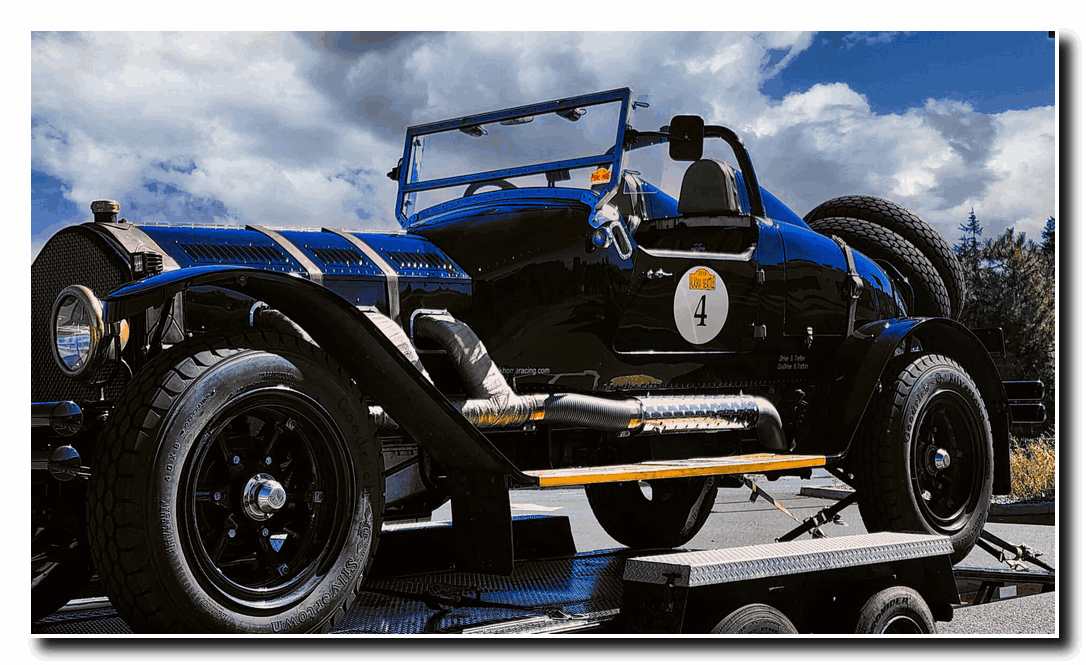
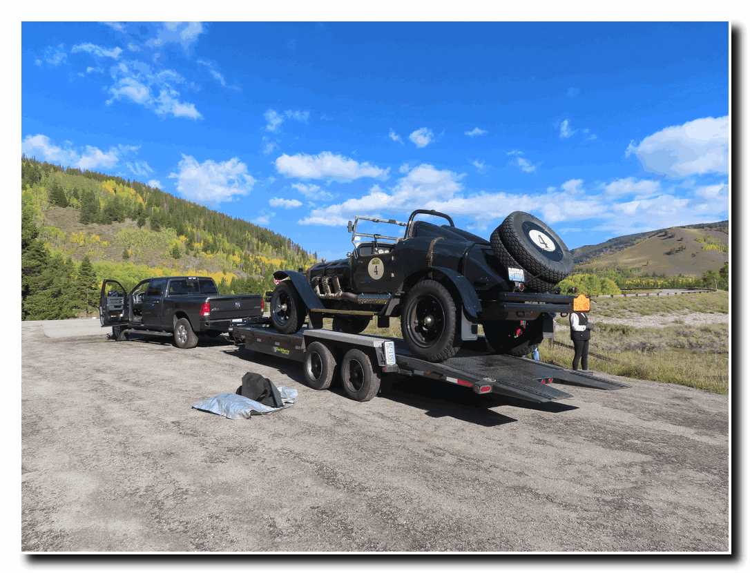
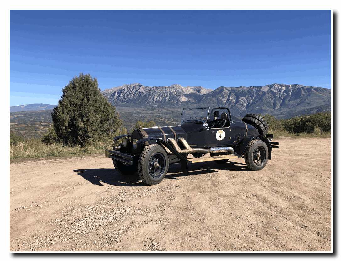
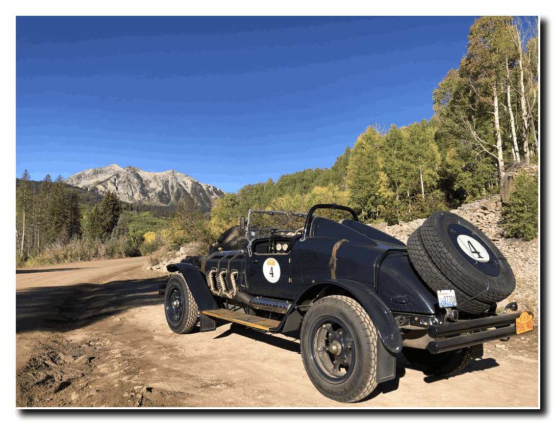
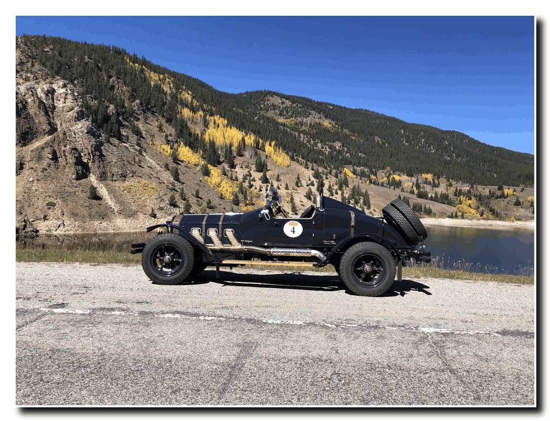
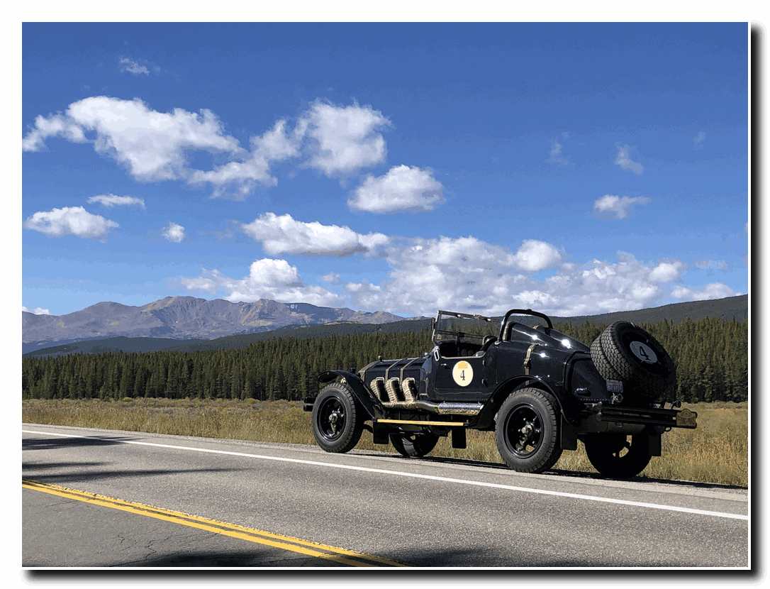
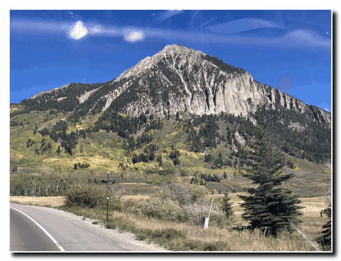
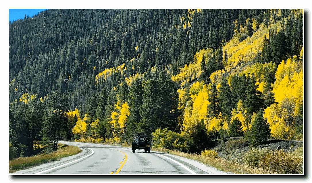
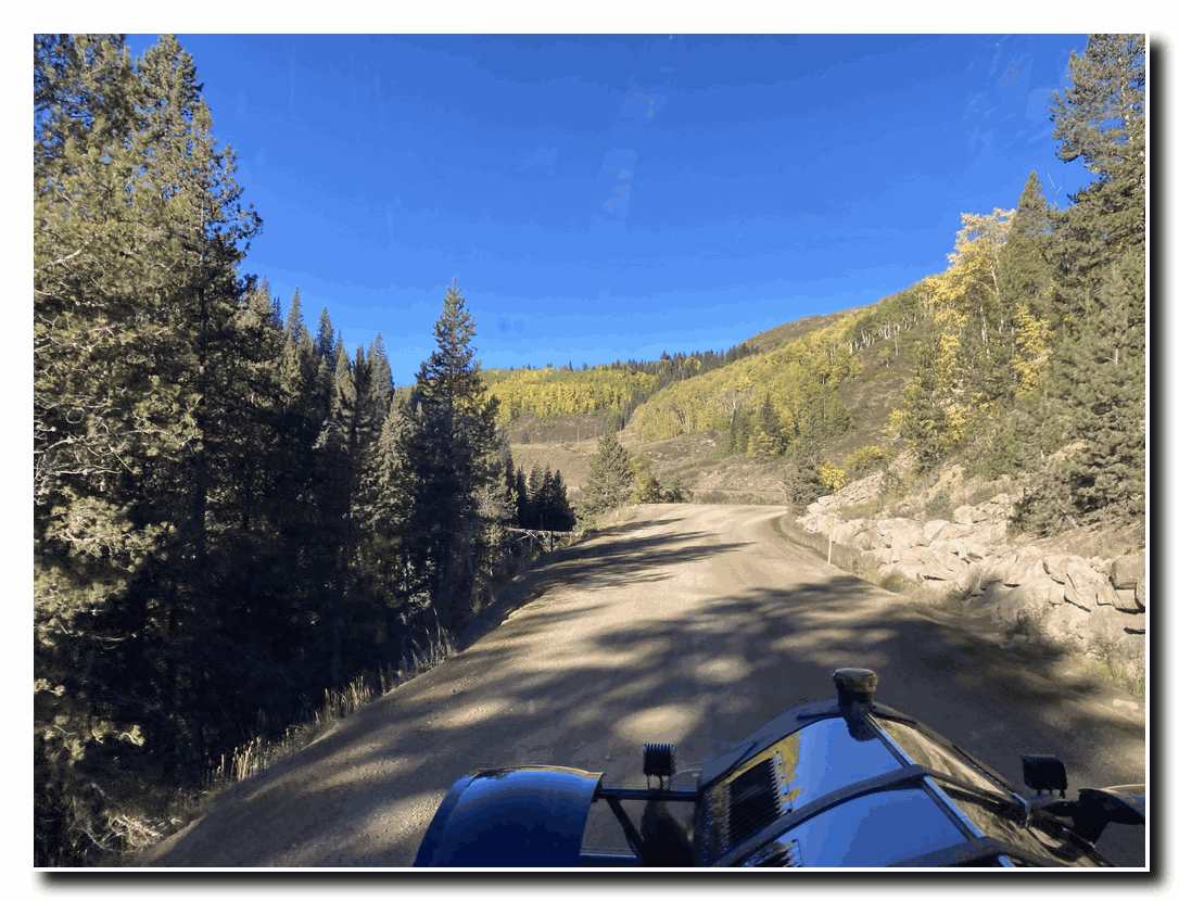
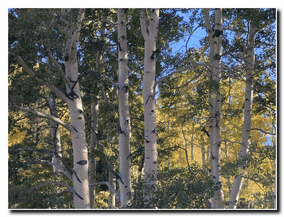
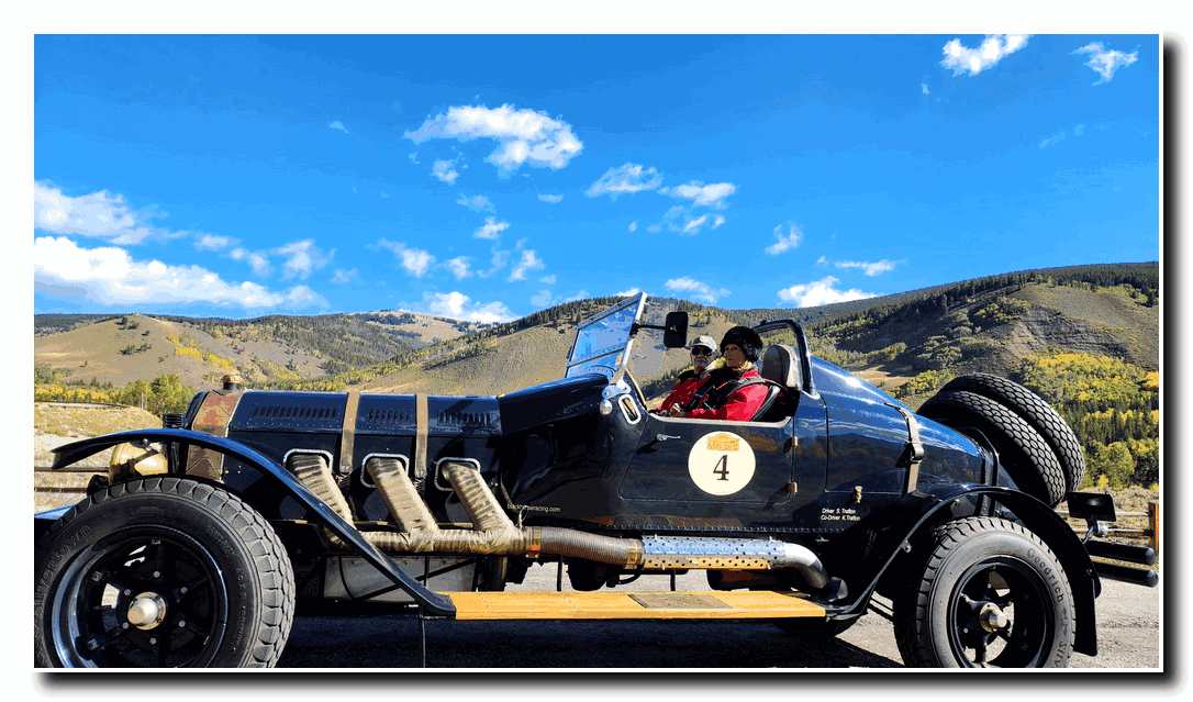
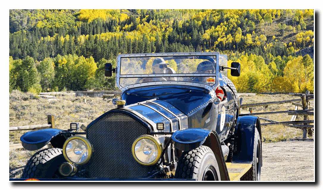
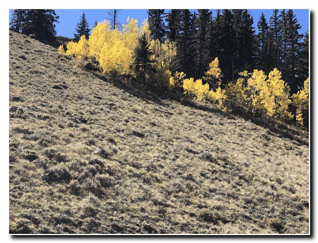
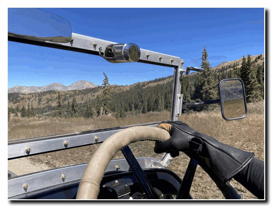
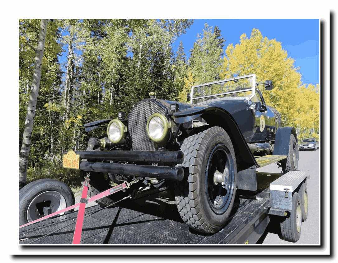
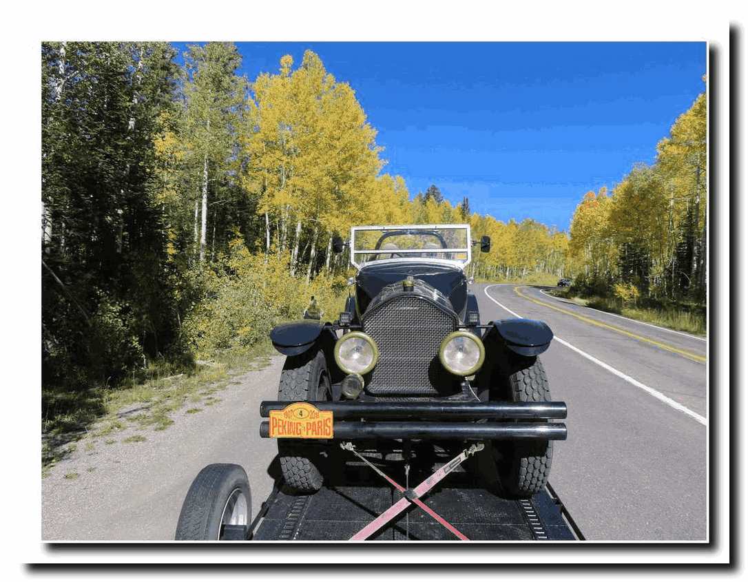
In late September, we drove to Colorado with the ALF #4 (or the American LaFrance speedster) following close behind us. Well, the ALF was on our trailer. But the scenery and fall colors that we anticipated while driving the central Colorado mountain range did not disappoint. 

Colorado Here We Come

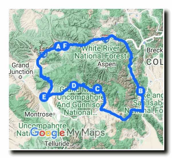
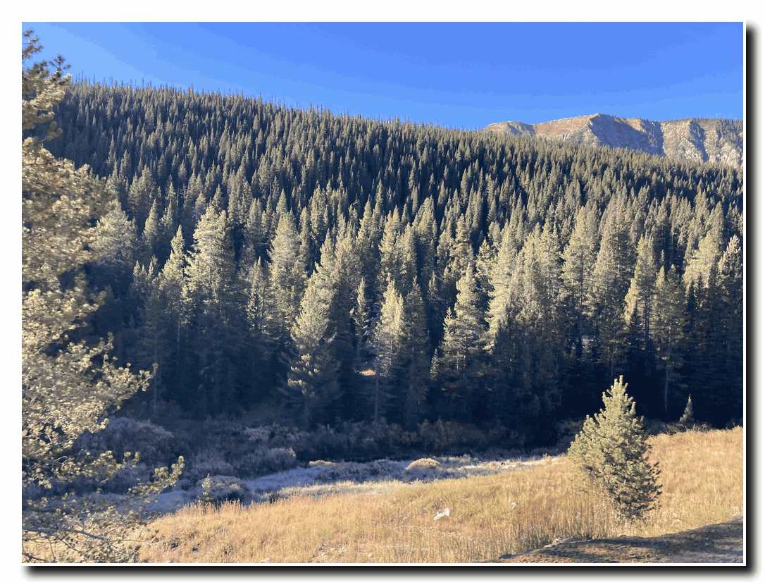
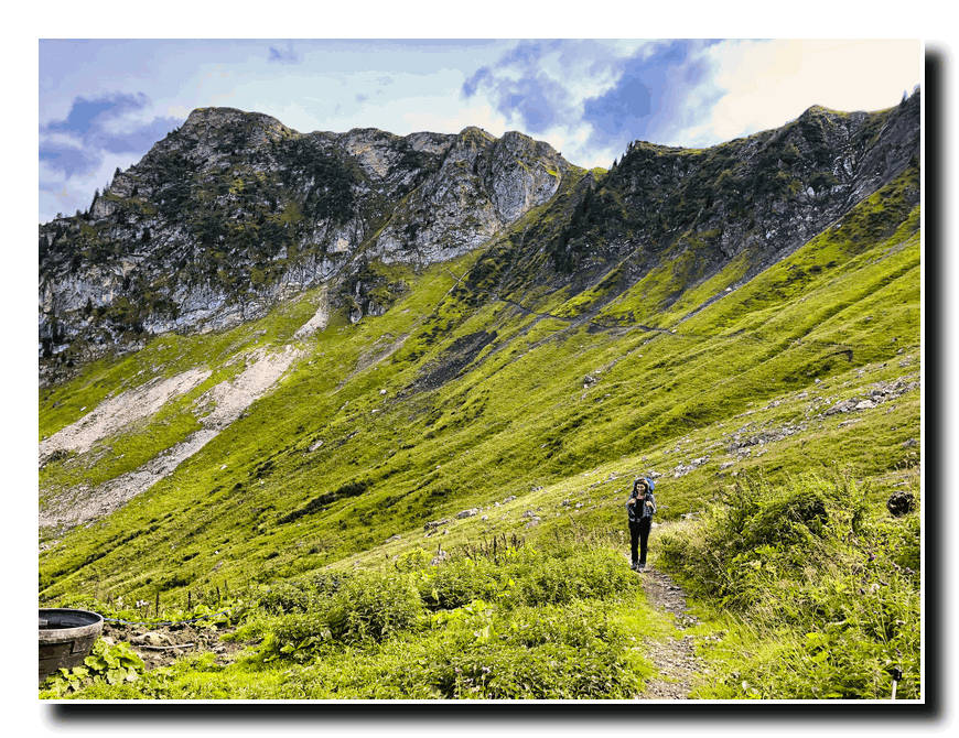
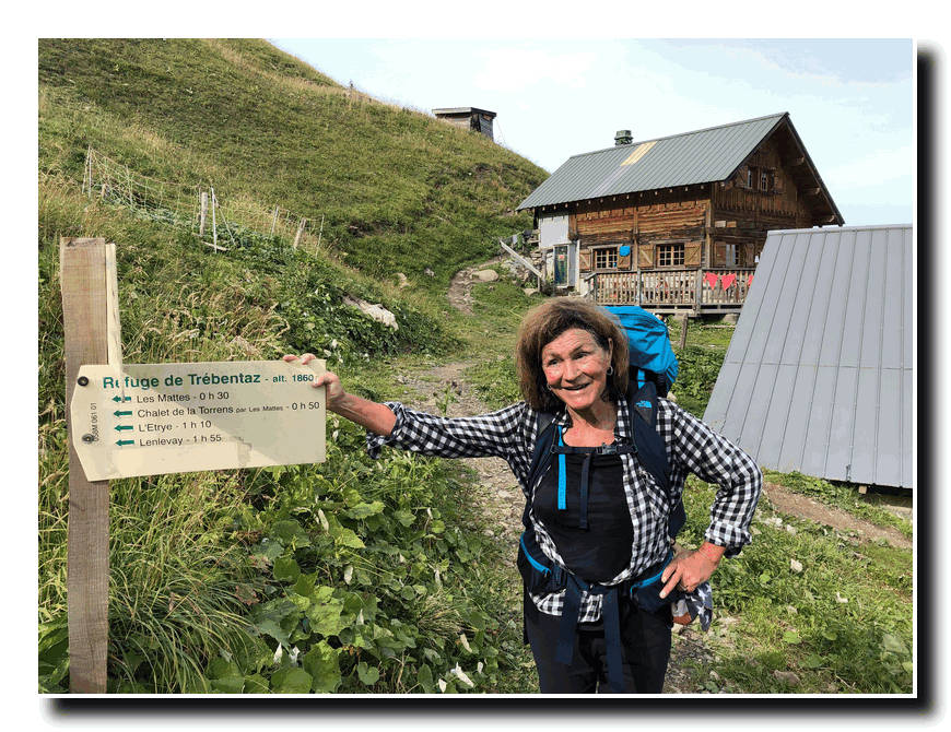
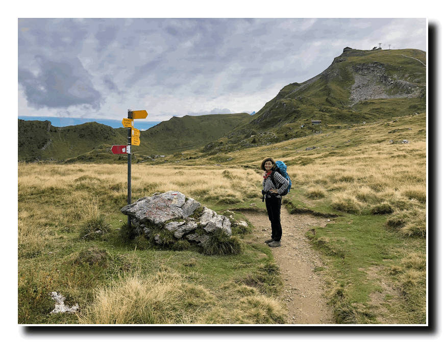
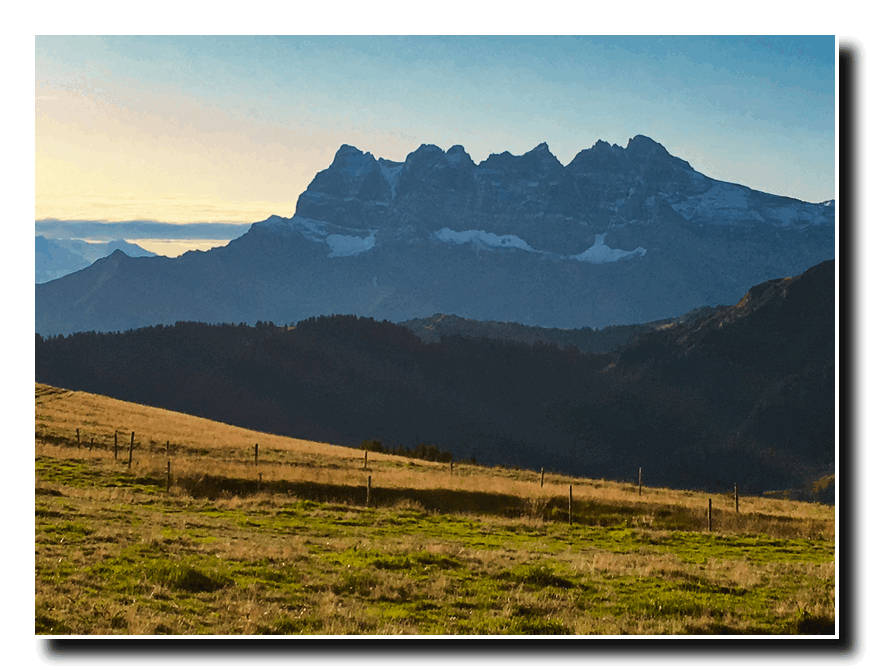
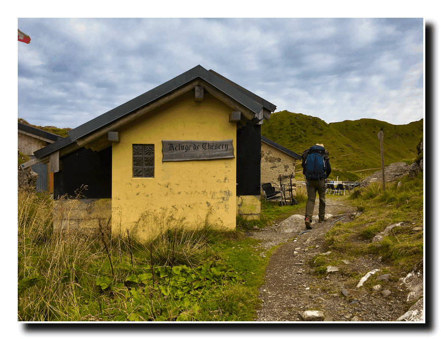
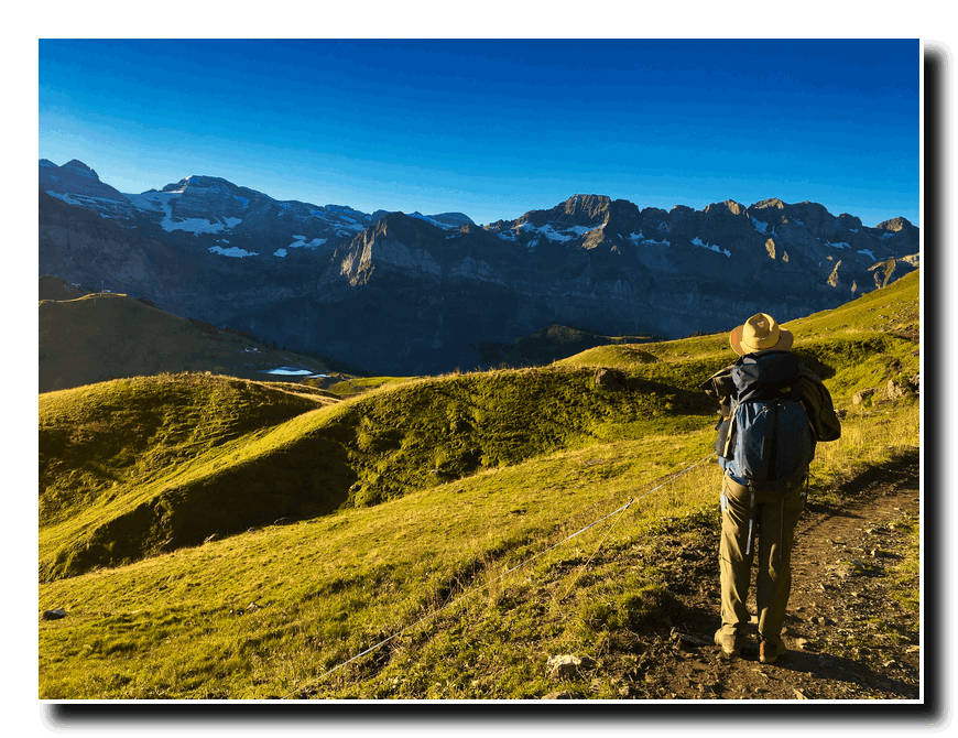
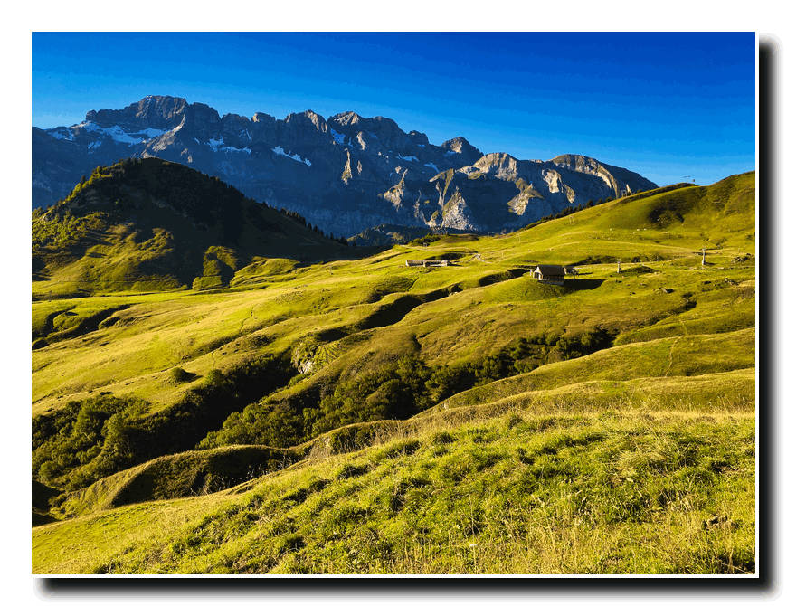
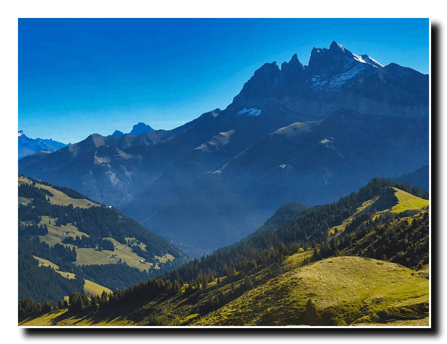
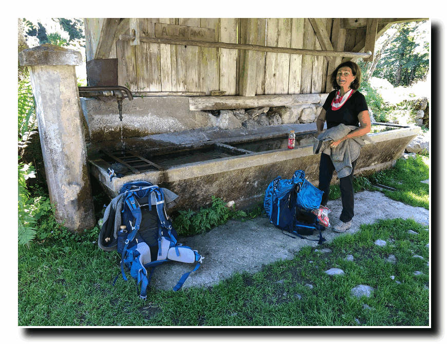
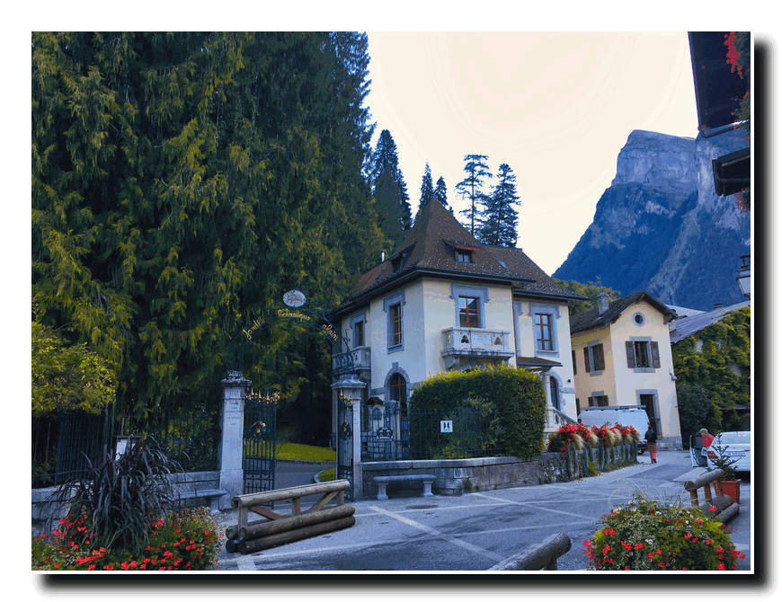
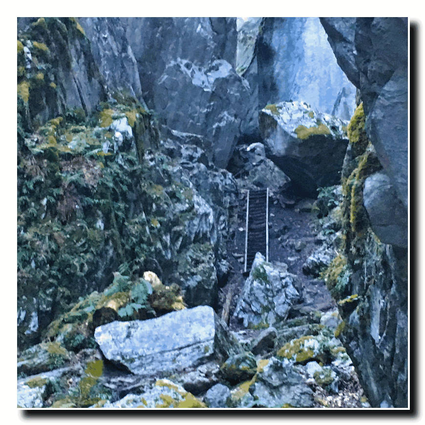
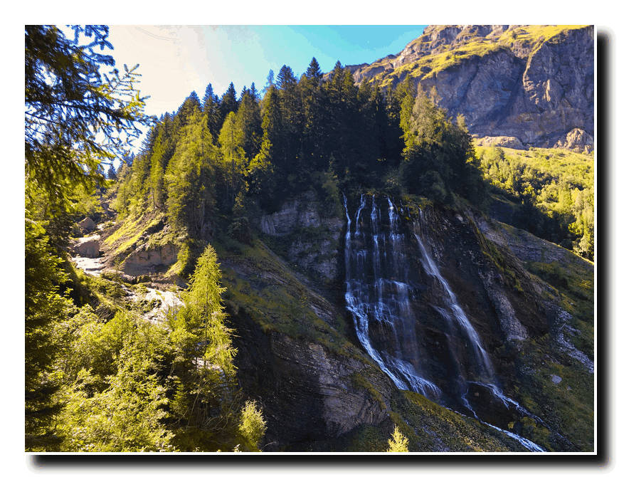
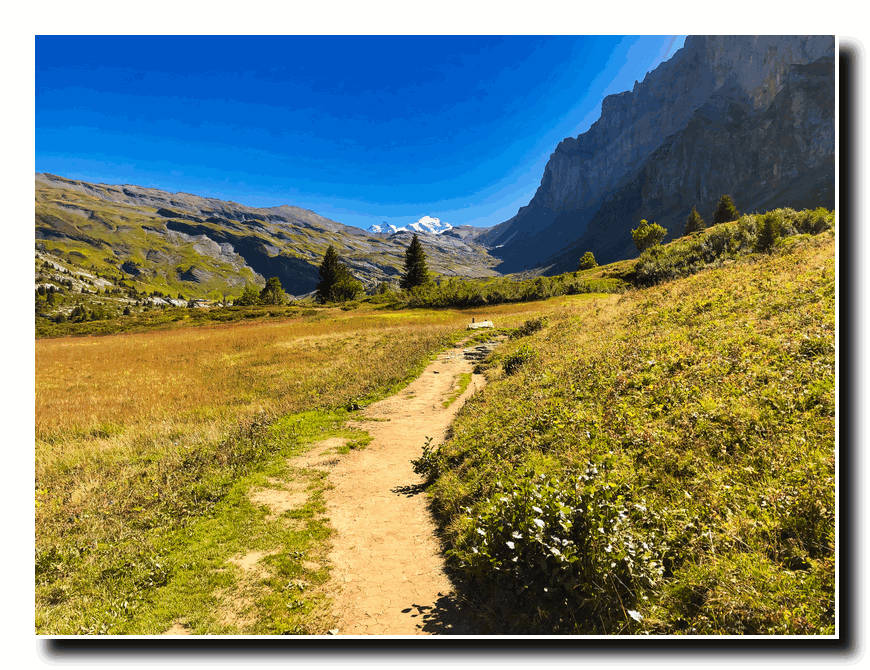
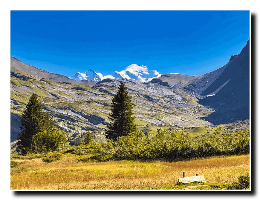
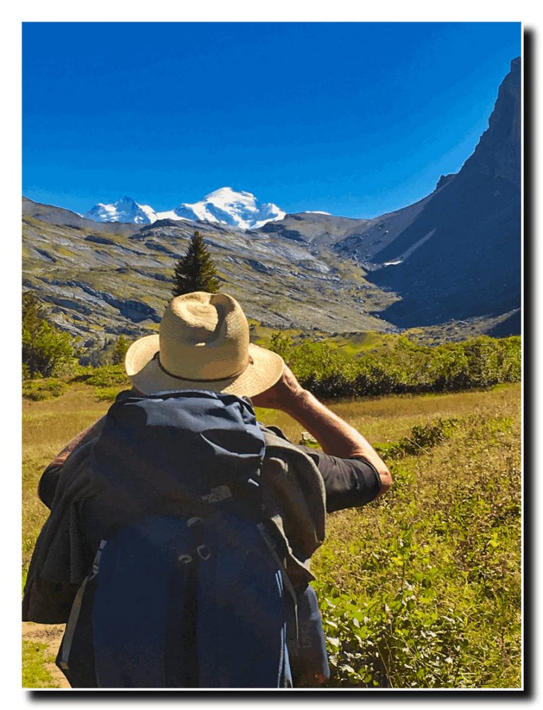
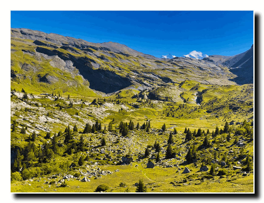
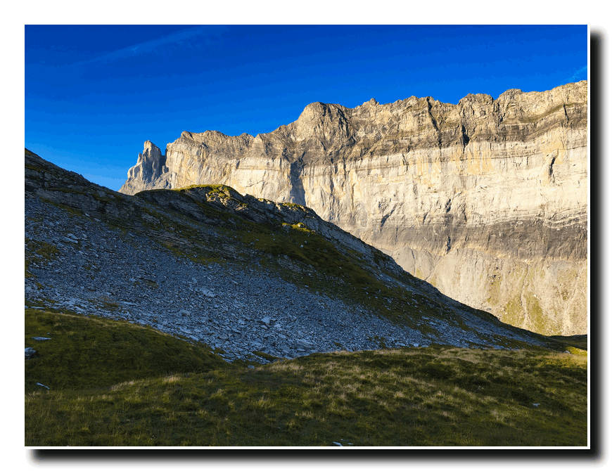
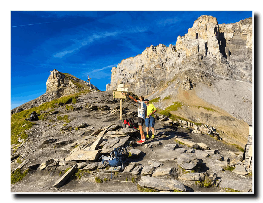
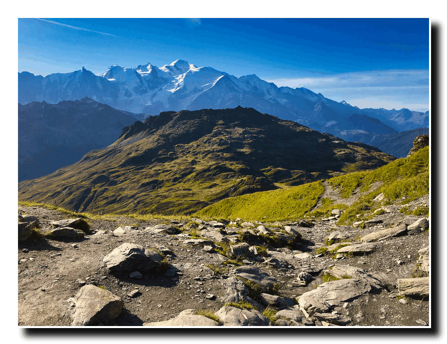
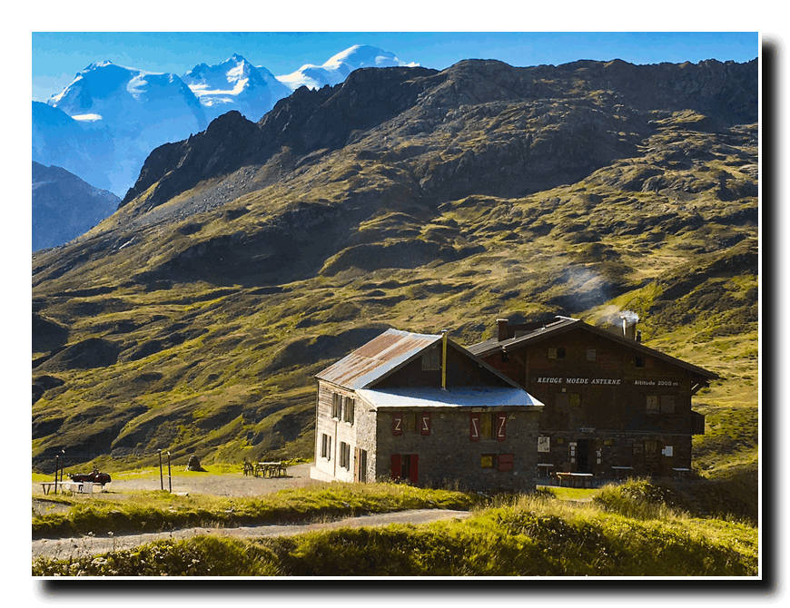
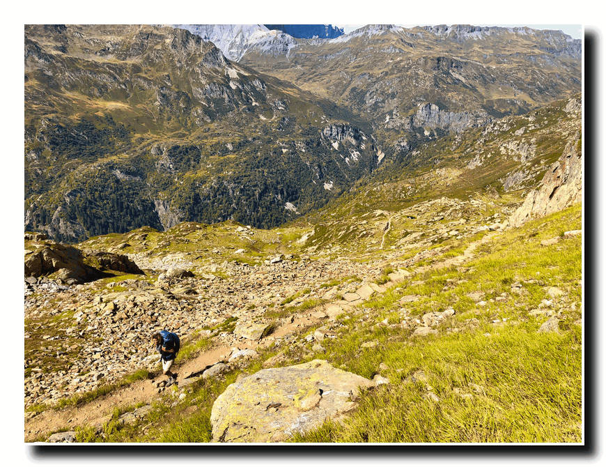
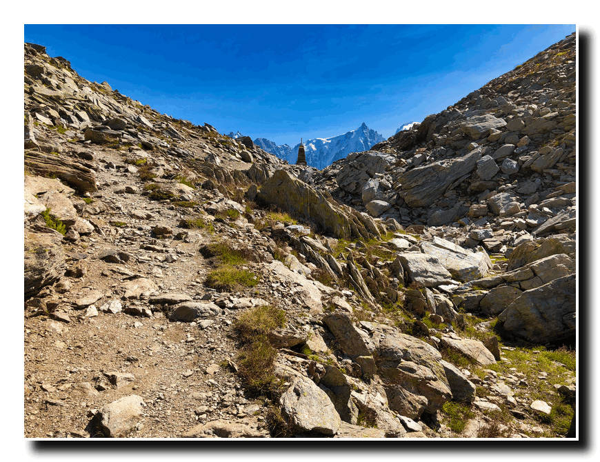
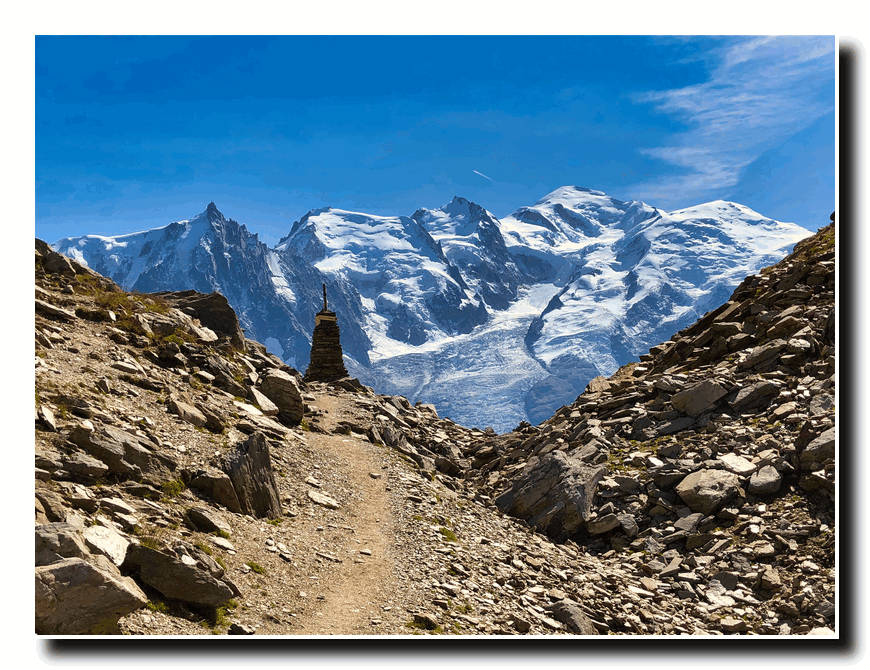
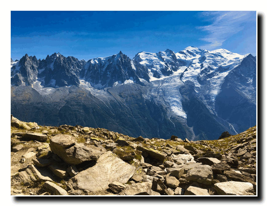
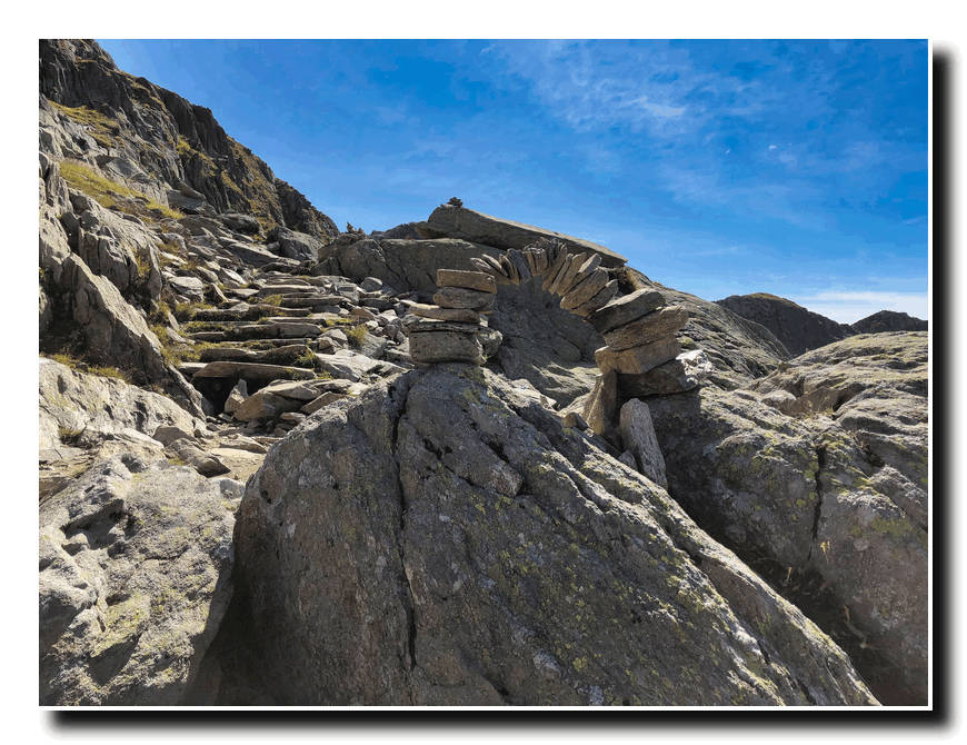
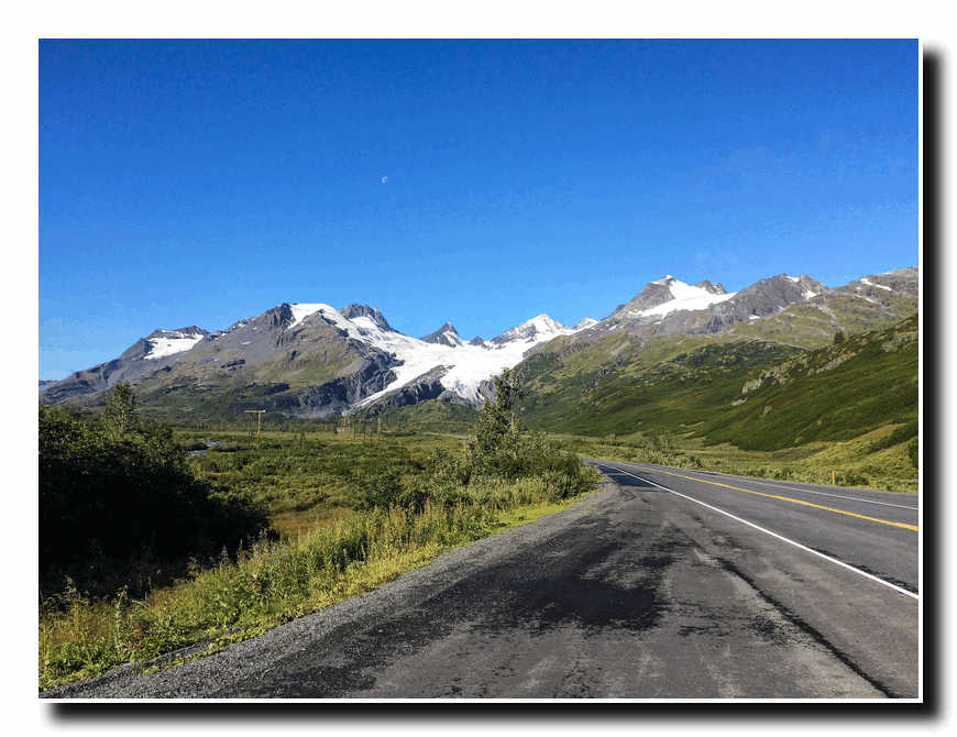
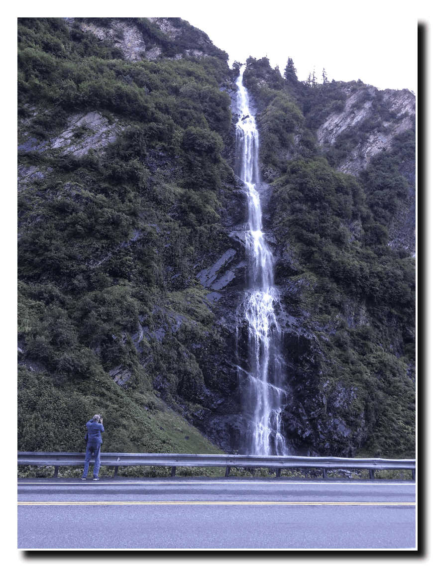
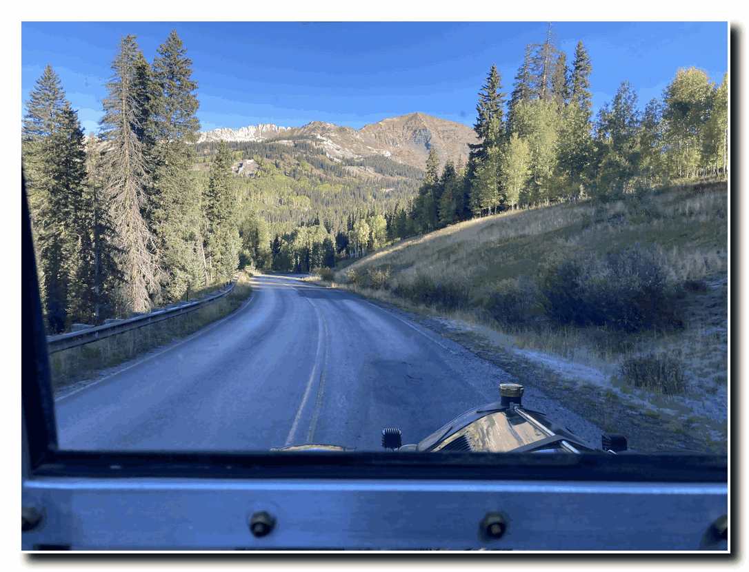
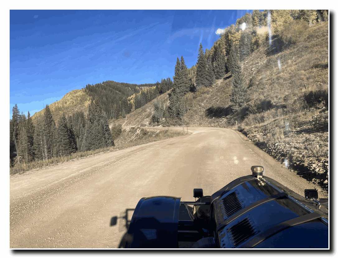
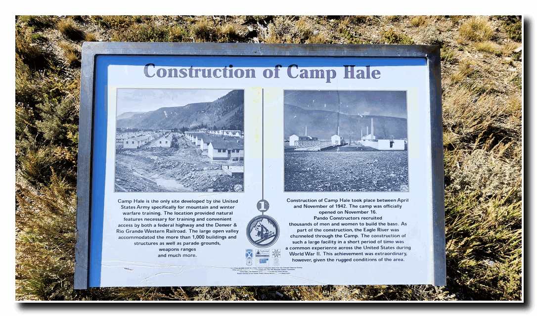
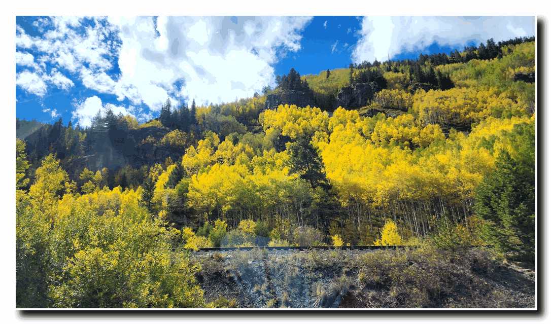
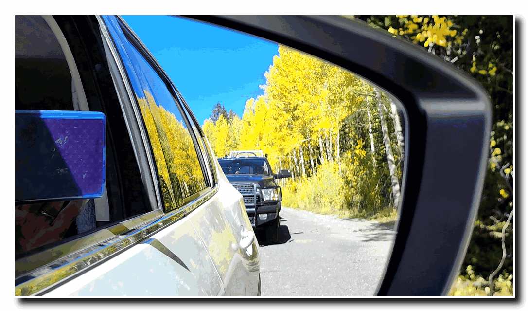
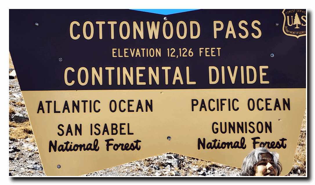
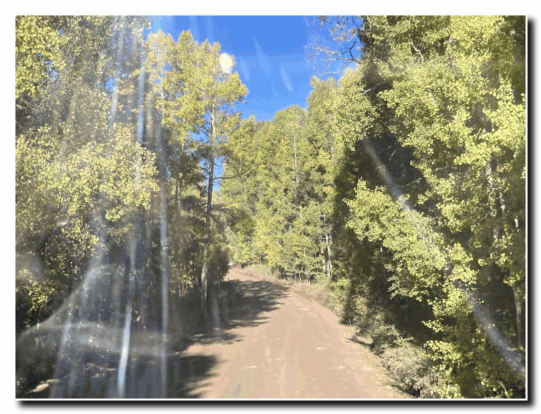
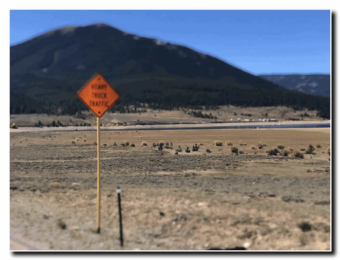
Starting at the famous World War II Camp Hale, Katherine and I chugged up the 10,000 foot Tennessee Pass on the continental divide and continued to Leadville. Then we drove along many backroads to Cottonwood Pass at 12,000 feet, and over Keebler Pass. What a journey it was. Here are some of our photos. 

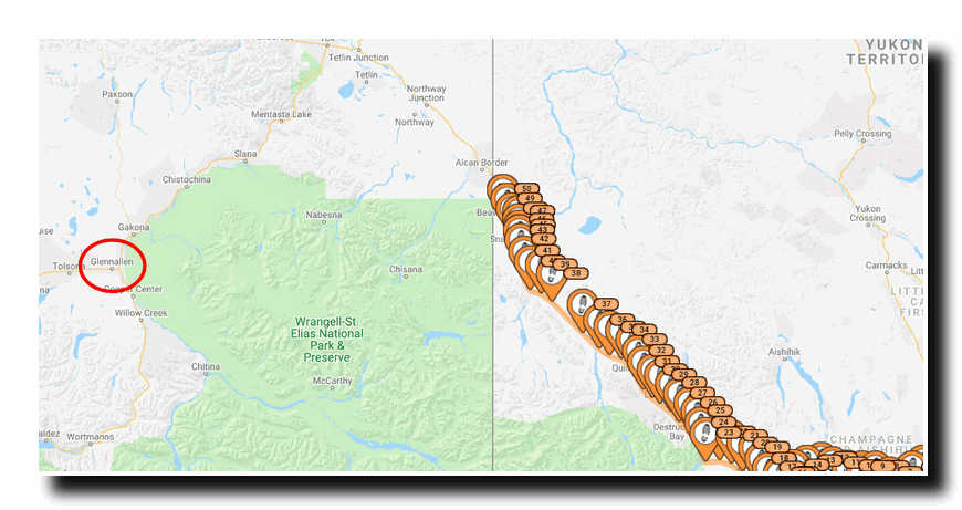
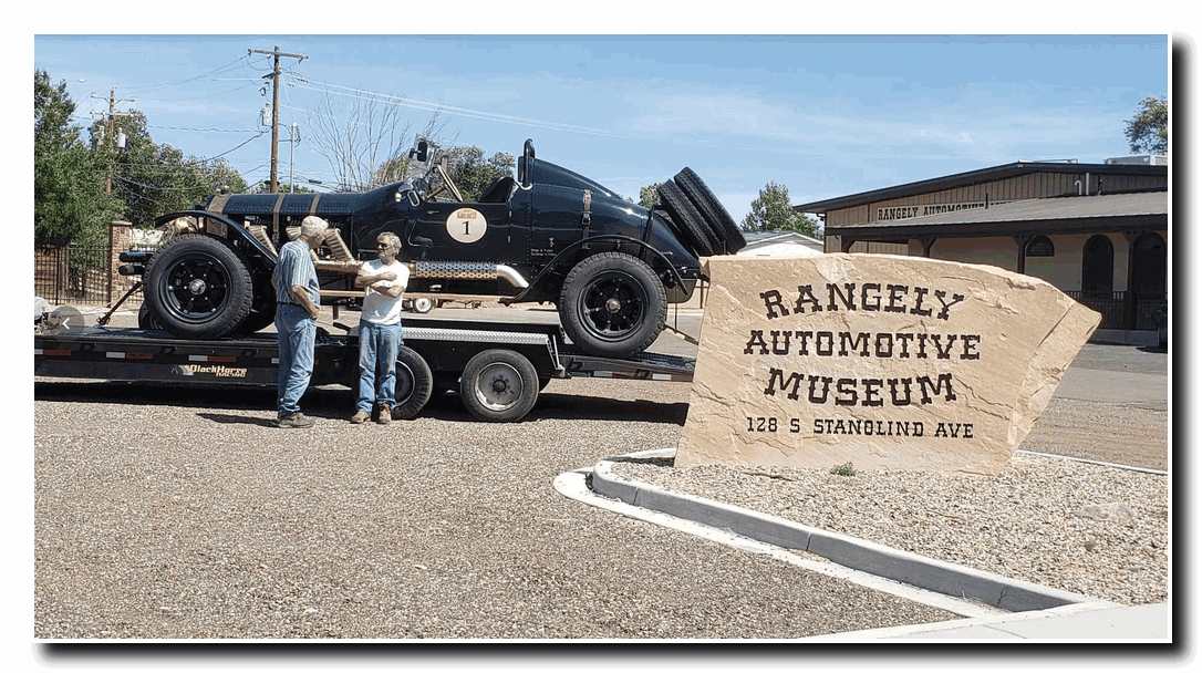
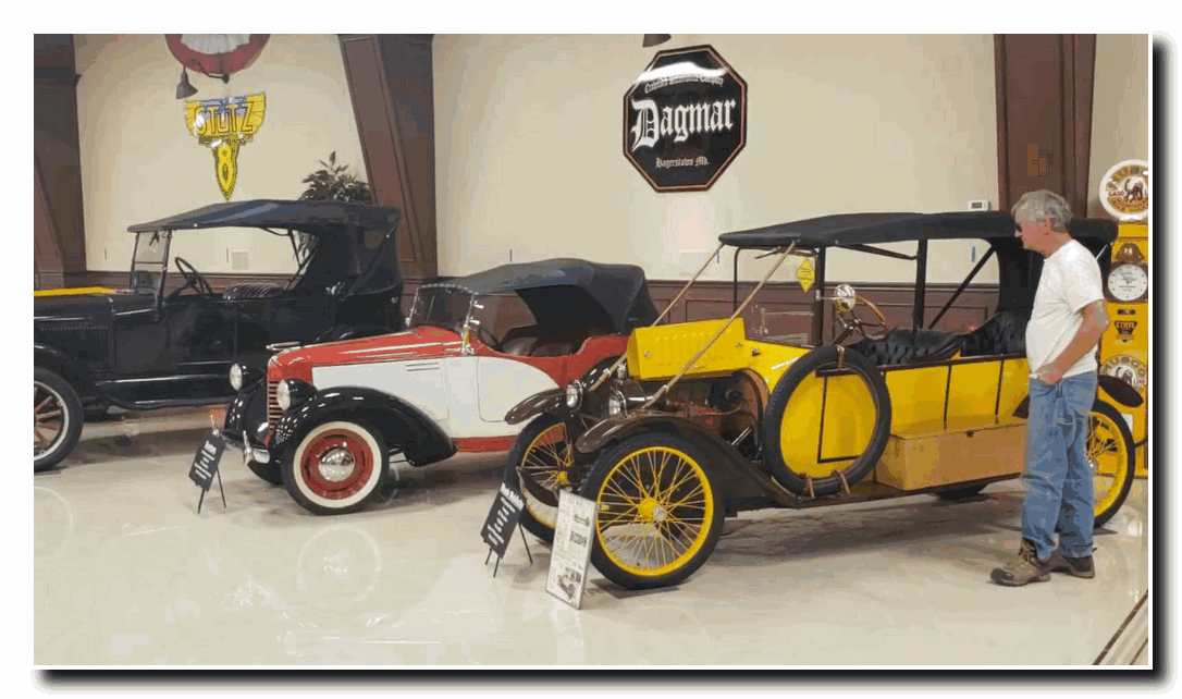
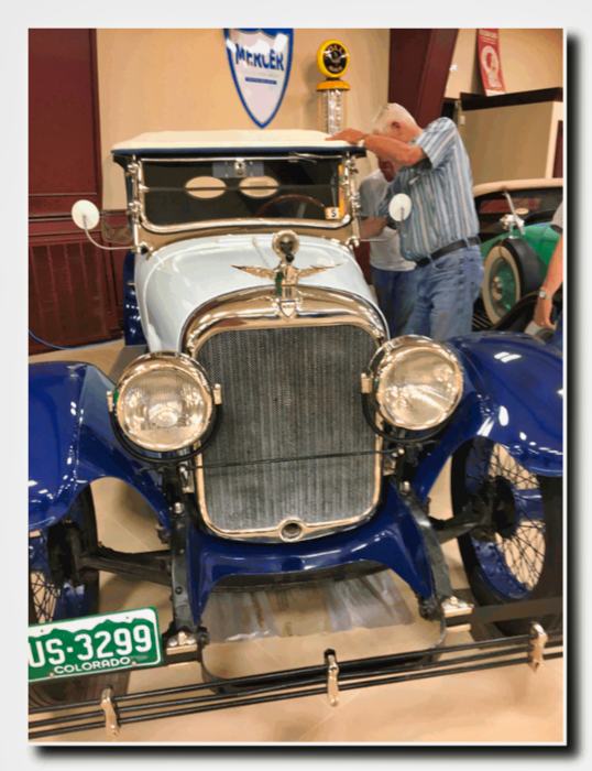
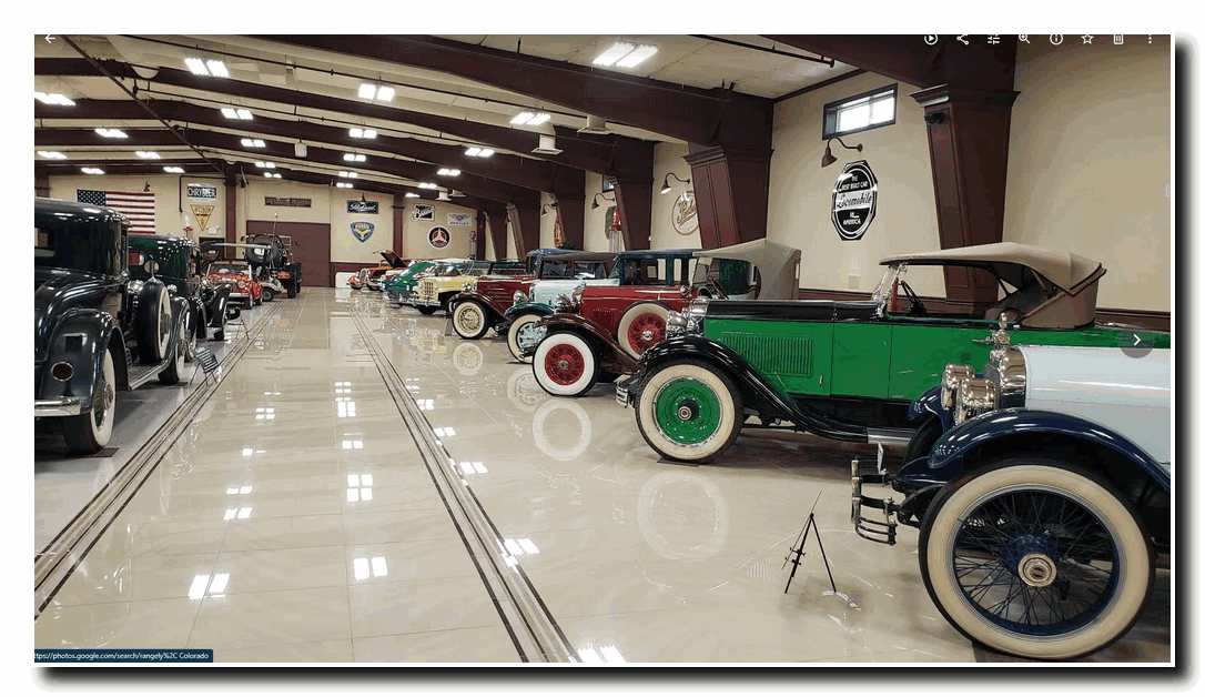
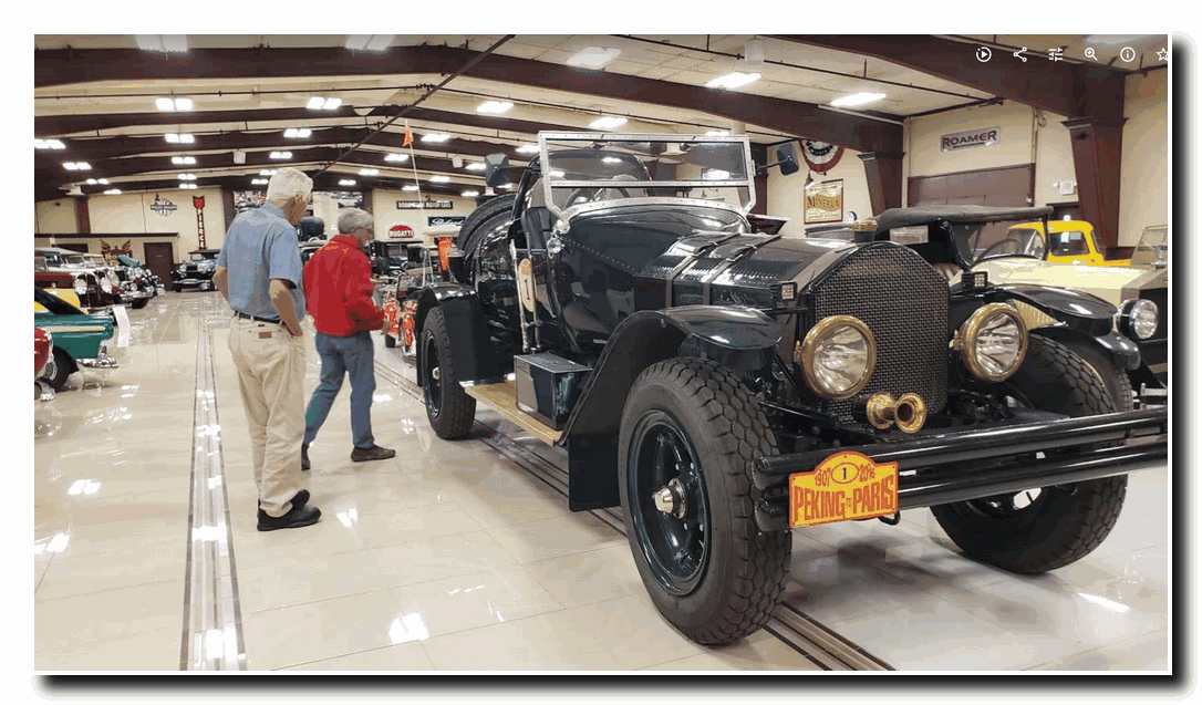
On the way back to our home-base in Washington State, we stopped at the Rangely, Colorado Automotive Museum to see our good friends Bud and Vicky Seigel, and also to check in on the ALF #1 which is a duplicate of the ALF #4. It resides at the antique car museum after its notable excursion in the Peking to Paris Race of 2016. Stop in to see it sometime.  

Book Projects

Book Project

Stephen Trafton

During 2020 we all found ourselves somewhat limited in our ability to pursue our “usual” schedule of activities. Travel was limited and for Katherine and I, a continuation of long-distance hiking projects in Europe had to be put on hold. Although we were able to do a number of interesting hikes in Washington, Oregon as well as several long-distance tours with the old ALF Speedsters in Colorado and down the Pacific Coast Highway, we found ourselves with a considerable amount of the year spent closer to our home on Whidbey Island.

Our solution to this dilemma took several forms. First, we began a series of musical concerts at our home. (See COVID CONCERT for a sample) We hope you enjoy it. In addition to the Covid Concerts, I thought this would-be good time to develop an “artistic” compendium of the most significant Arctic Expeditions I was fortunate enough to be involved with during the 1970s and 1980s. The result was a two-volume, large format set of books outlining these expeditions and displaying, what I thought were the most compelling images. I hope you enjoy them.


To read and view more pictures from these expeditions go to Arctic tab in the menu above, or click on these links below:

Arctic Explorations Volume 1

Arctic Explorations Volume 2

Arctic Exploration in the Year 1978, 1980, 1981 and 1982.

Volume 1

Volume 2

Back Roads Speedster Trip

Taking The Back Roads to Rangley

The Big Sky and the American LaFrance vehicle.

Back in July (2019), Katherine and I, along with our friends Alan and Nancy Bixby loaded our 1915 American La France Speedster on its trailer and left home for a two-part tour of the western states, during which we would drive our old race car over 850 miles. We started by driving to New Halem, Washington where we unloaded “The Revenant” and started up over the North Cascade Highway toward Washington Pass. Our old chain drive ALF performed admirably, chugging its way up through the mountains past Diablo Lake, up to Rainy Pass (4875’) then on for another four miles, past Cutthroat Peak to Washington Pass (5476’).

.

The view from the pass was spectacular with Liberty Bell Mountain (7720’) rising above us. From here we began our descent toward the town of Winthrop, pausing briefly to photograph Silver Star Mountain and the Wine Spires just east of the Pass. Soon we reached the Methow River Valley and stopped in Winthrop for lunch and to load the ALF back on its trailer. After our rest stop, we headed down along the river to the town of Pateros, Washington at the confluence of the Methow and Columbia Rivers before continuing on to Grand Coulee where we spent the night camped out on Lake Roosevelt.

The next day we drove to Fort Spokane where we off-loaded the ALF and drove north along the Columbia River to Kettle Falls, Washington. We reloaded the ALF on the trailer and then drove east on Highway 20 to Tiger, Washington and south along the Pend Oreille River to Newport, Washington. From here we drove on east to Sand Point, Idaho where we spent the night.

After having a restful night at Sand Point, we drove north to Bonners Ferry, Idaho then south to Libby, Montana. Just outside Libby we off-loaded the ALF and started on a beautiful fifty-eight-mile drive north along the eastern side of Koocanusa Lake to Eureka, Montana. After searching in vain for a suitable campground, we settled for camping out under the stars in the town park. We should have taken note of the nice green grass we were camped on in an otherwise parched landscape, because at two a.m. the sprinklers came on and Katherine and I had to beat a water-soaked retreat to our truck till the next morning.

.


The next day, we trailered the ALF seventy miles to Whitefish, Montana where we off-loaded and started our drive to Glacier National Park. We followed Highway 2, along the middle fork of the Flathead River up through the mountains and then on to Marias Pass (5222’). The climb up to the pass was a long one and the ALF’s 14.5-liter engine overheated several times which meant that we had to stop occasionally to add water to the radiator and let the engine cool down. But the old warhorse chugged on and by mid-afternoon we had made it to East Glacier Park Village where we stopped for the night.

We got an early start the next day and, with the ALF back on its trailer we drove on to Browning, Montana then south to Choteau and on to Helena, Butte and finally Anaconda. We off-loaded the ALF here and drove the last forty miles up into the Big Hole where we made camp at Fish Trap Campground along side the Big Hole River.


After a restful night at a beautiful campsite next to the river, we decided to drive the ALF on a “Grand Tour “of the Big Hole Valley and the Pioneer Mountains. First, we drove south along the Big Hole River to the Town of Wisdom, and then on to the town of Jackson. From Jackson we followed the road up and over Big Hole Pass (7360’) then to a back road running north through the Pioneer  Scenic Byway to Wise River. This section of the tour was challenging with its steep up and down hill sections and many hairpin turns. I should mention here that the ALF weighs in at 8000 pounds and has no power steering so it is not a trivial undertaking to drive it. But all the effort was well worth it, given the scenery which surrounded us.

.

After our drive through the Pioneer Mountains we came to the town of Wise River. From here it was but a short drive back to our campsite and a welcome cocktail hour.

On the day after our “Grand Tour” we packed and departed the Big Hole for Salmon, Idaho. First, we drove down the valley back to Wisdom and then due west for twenty-six miles, over the Continental Divide at Chief Joseph Pass (7252’) and then over Lost Rail Pass (7014’) before heading south toward Salmon. Once again, the road was steep and there were numerous hairpin turns, but soon we were in the Salmon River Valley. Here, the going became easier. We stopped at the outskirts of Salmon and loaded the ALF back on the trailer before driving south to Idaho Falls and then east to Alpine, Wyoming. We pulled over into a rest stop, unloaded the ALF and drove south along the Idaho/Wyoming border for eighty-one miles to Cokeville, Wyoming. After a short rest stop and reloading ALF on its trailer we drove on to a campground at Manila, Utah where were spent the night.

The next morning, we off-loaded the ALF once again and left Manila and then entered the Flaming Gorge National Recreation Area. We turned off the main road, Highway 44, at Sheep Creek and drove the “road less traveled”. This drive was well worth it. While we had to contend with poorly maintained sections of primitive road and a steep winding drive to 8300” before returning to the main road, this loop drive was spectacular. Bright colored sandstone, beautiful aspen grooves and vistas of the surrounding mountains combined to make this portion of the trip literally the high-point.

.

After returning to the main road we drove on along a high mountain plateau before coming to the long steep descent into the town of Vernal, Utah. Once again, the challenge of a steep descent, punctuated by many hairpin turns made this section a struggle.  But to rest is not to conquer! At last we reached Vernal. During this arduous day, ALF had started misfiring occasionally and by the time we reached Vernal this misfire had become progressively worse. An electrical issue had arisen and we would have to deal with it before we drove much further. In addition, the weather had turned hot. Afternoon temperatures were nearing 100 degrees.

.

As we left Vernal, I was trying to come up with a Plan B. How to fix the ALF, and how to deal with the heat, which would only get worse as we headed south to Moab, Utah. While I mulled this problem, we drove on heading southeast, crossing the Utah/Colorado border at Dinosaur. We maneuvered through the Coal Oil Basin and arrived at Rangely, Colorado where we stopped for gas. As I was pumping fuel and doing a safety check of the trailer, a tall, lanky fellow, about my age (73) came over to me and  asked the usual questions about the ALF. As we talked, he mentioned that he had a car collection and that we should stop by and he would show it to us before we left town.

.

I really did want to get moving down the road right then, but there was something about this guy that piqued my interest. So I agreed to follow him. We drove about a quarter mile and he turned into the parking lot of a beautiful building with a sign out front that said Rangely Automotive Museum. This guy was for real!

He introduced himself as Bud Striegel and he had been collecting cars and motorcycles for decades. As a businessman Bud had run an oil pipeline construction company. Now that he was semiretired, he was devoting more time to his car collection. He recently had finished building his museum which he opened to the public and was just enjoying life. After we toured his collection I said, “How would you like to have the ALF on loan for a few months in your collection?” So, we struck a bargain. He could have the ALF at the museum till October, when we would return, after the weather cooled down to pick it up and continue on our way to Utah. In the meantime, I wouldn’t have to trailer the ALF home and trailer it back to Colorado to finish our tour after the weather cooled.

.

And so, thus ended the first leg of our tour. We had driven the ALF five hundred miles, were in position finish the tour in the fall, and had meet a new friend along the way.

Traftons Make Fall Hikes in Europe

The Grand/Grand Traverse


Over the past ten years Katherine and I have undertaken a “Grand Traverse” of Europe. Our goal has been to hike from the headwaters of the Thames River to the Slovenian border. After completing the Thames River Trail in 2010 we then set out from Ostende, Belgium and hiked across Belgium to the intersection of the Belgium, Luxemburg and German borders. Then south along the Luxemburg/German border to France. After that we would hike south across eastern France to Lausanne, Switzerland. From Lausanne our trek continued via a high route across the Swiss Alps to Lichtenstein and on along the mountains of the Swiss/Italian border. Our route then followed the Italian/Austrian border through the Dolomites and Austria’s Leinzer Alps to Plockenpass near the Slovenian border.


As of the beginning of September, 2019 we had completed all but a small segment of our intended route about 150 miles in length, in southern France between St. Maurice sur Moselle, France and Lausanne, Switzerland. For “extra credit” we had also completed a hike around and over Mont Blanc (2010), around the Matterhorn (which I climbed in 1996), and the famous climbers “Haute Route’’ between Chamonix, France and Zermatt, Switzerland (2012).

Since we were nearly at the end of our “Grand Traverse” we decided to expand the project by adding a traverse from Lausanne to Monaco on the Mediterranean, thus turning our traverse into a West/East and North/South” Grand/Grand Traverse” of Europe.

This September Katherine and I set out to complete the first leg of our Lausanne to Monaco hike and to then head north and whittle anyway at the remaining 150 miles of our West/East European traverse.

High Level Route La Chapelle D’Abondance to

Chamonix, France

September 9, Katherine and I flew to Geneva, Switzerland and then took a train to Montreux. After overnighting in Montreux, we took a short train ride to Monthey, Switzerland then hired a car to take us to our starting point at the Hotel Les Cornettes in La Chapelle D’ Abondance (3350’), France.

I should add that in 2014 we had hiked over the mountains from Lake Geneva to our starting point, but persistent rain storms prevented us from going any further.

We started along the road out of town and, in about a half mile turned right at the metal cow sculpture and headed up into the foothills toward the Trebentaz Hut (6102’).

After about three hours, we arrived at this scenic perch high above the Valle D’ Abondance.

The next morning, we set off from the hut and climbed up and over a pass (7000’), and then down and across a beautiful plateau to the Col de Bassachaux (5833’).

After a short rest we continued  across rolling terrain to the Col de Chesey (6535’) on the Swiss border.

From here it was a short hike to our stopping point at the Refuge de Chesery (6470’) where we spent the night.

On the 12th, we left Chesery and hiked up to the Portes de I’Hiver (6877’)…

…and then down once again Chaux Palin (6047’) and across a long rolling plateau…

…and down to a farmhouse at La Poyat (5347’). Here the trail rose sharply up to the Col de Croux…

…and into France once again. Then it was down again to 4660’ before climbing up to the Col de la Golise (5453’). From the Col de la Golise it was a long downhill trudge to the village of Samoens (2306’). This strenuous day had a total ascent of 2200’ and a total descent of 6365”!

We set out from Samoens at eight the next morning (the 13th) and hiked along a river for about two miles before beginning our hike back up once again. We hiked up the Gorges des Tines, using ladders to climb past several cliffs…

…and on upward to the Chalet de Lignon (3870’) where we had lunch before continuing on up the Collet d’Anterne (5892’).

Here we were treated to our first view of Mont Blanc. We had reached another high plateau and it was but a short walk to our stopping point for the night the Chalets d’Anterne (5932’).

On the 14th we continued on and hiked up to the Lac d’Anterne (6750’) and then up to the Col d’Anterne (7405’), a 5100’ ascent from Samoens.

Then it was down again to the Pont d’Arleve (5240’, a bridge across a small river at the bottom of the valley. From here it was a three hour slog up a mountainside to the Col du Brevent (7769’). What a view!

The entire Chamonix Valley lay before us. After a short rest we headed on up the Le Brevent (8284’).

Here we intersected the trail we had taken during circuit of Mount Blanc in 2010. After resting on top of Le Brevent we took the tram down to Chamonix and spent the night before heading north to the St. Maurice sur Moselle.


Hike Between St. Maurice sur Moselle, France and

Porrentruy, Switzerland

September 15:  After a good night’s rest and some great French cuisine in Chamonix, Katherine and I set off for St. Maurice Moselle, the endpoint of our hike through the Moselle River Valley, about 150 miles north of Lausanne. We traveled by bus from Chamonix back to Geneva, where we caught a train to the beautiful town of Strasbourg, France where we spent the night. The next morning, we traveled by train to Nancy, France and then to the small town of Remiremont, France.

September 17th, we left Remiremont and traveled by bus to our starting point at St. Maurice sur Moselle.

We hiked up a trail which climbed from the Moselle River Valley up to the summit of the Ballon d’Alsace. We took a short rest here and admired the great Bronze Statue of Joan d’ Arc.

From here we hiked a short distance down the road to a statue commemorating the lives of soldiers tasked with disarming land mines during World War II.

Then we followed a trail on down through the forest and along the La Savoureuse River to the town of Lepuix and on to the town of Giromgny, France, where we spent  the night.

September 18th, we left Girongny and hiked out of town where we picked up the trail through the foothills and down to the village of Bas-Evette. From there, largely on bike paths, we hiked another ten miles into the city of Belfort, France where we spent the night and planned the last leg of our route to Porrentruy.

September 19th, we left Belfort and hiked on country roads and bike paths east to the small town of Delle, France and then took the train to the town of Porrentruy, Switzerland.

September 20th, we took the train back to Delle and hiked a short distance along the road to the Swiss border at Boncourt, Switzerland in the foothills of the Jara mountains.

From Boncourt we followed trails through foothills and along a river valley to Porrentruy.

We now had only about one hundred miles left to go on the West/East European traverse. Our plan is to complete this last segment of our journey in the Spring of 2020.

Traftons in Peru

High Adventure Begins

.

.

June 6, 2019: Katherine and I flew from Seattle to Dallas, then boarded our flight to Lima which landed in Cusco, Peru. We arrived on the morning of June 6 and spent the day with a walk around Cusco while acclimating to the 11,250-foot elevation of the Andes Mountains.

.


June 7, 2019: We spent this day taking longer walks which included several up and down hill-climbs in town. Then we watched the military parade at the central square celebrating Inti Raymi’rata…or the summer solstice… which actually occurs later in the month.

.

.

(Click image to view large size.)

.

.

June 8, 2019: We moved to our new hotel and met the rest of our hiking group. Afternoon was spent touring the city of Cusco, which included a visit to the Santo Domingo Church built atop the ruins of the Inca Temple Coricancha (Temple of the Sun). In the late afternoon we drove to the top of the hills around the town and walked through the ruins of Sacsayhuaman, a magnificent Inca fortress.


.

June 9, 2019: On this morning, our group boarded a van which would drive us to the starting point of our hike through the Andes. Along the way we stopped at the Inca site of Quillarumiyoc. Then we drove on to Mollepata, a small town where we had lunch before continuing on to Challacancha at 11,900-feet. Here we would start our hike of two and a half miles. There was 800 feet of elevation gain to Soraypampa and our accommodations at the Salkantay Lodge. The lodge is situated at the edge of Soraypampa and is dominated by spectacular views of Humantay Peak (19,412 feet) and Salkantay Peak (20,500 feet).

.

.

June 10, 2019: We started early for a 1,200-foot hike up to a beautiful emerald green Humantay Lake, nestled below the imposing peak of the same name. Once we had explored around the lake we continued up to the top of a knoll (14,000 feet) where a shaman blessed tomorrow’s hike over Salkantay Pass (15,213 feet).

.

.


June 11, 2019: We started early again for our 8 mile hike over Salkantay Pass. Leaving Soraypampa behind, we made a gradual ascent up the valley toward Salkantay Peak. Rounding Humantay, the trail steepened as we switch-backed toward the pass. Since the group was moving a little slowly for Katherine’s and my pace, we moved ahead and arrived at the pass about 20 minutes before the others. The hike to the pass was about four miles and 2523 feet of elevation gain. After a short rest at the pass, we began the 4-mile descent to the Wayra Lodge (12,812 feet) where we spent the night.

.

.

June 12, 2019: Starting at about 9 am we began our 3400-foot descent down from the breathtaking alpine scenery we had enjoyed during the last few days and then disappeared into the cloud forest below. Three hours later we arrived at the Colpa Lodge (9,914 feet), located on a 1,000 promontory above the confluence of three rivers.

.

.

June 13, 2019: Today we continued to descend by hiking down a step-way trail into the Santa Teresa River Valley. After 5 or 6 miles we began to hike past coffee plantations, banana trees and passion fruit orchards. We hiked on for another two or three miles to a big suspension bridge which crossed the Santa Teresa River. We met a van which drove us about 30 miles down valley and then hiked up an old trail to Lucma Lodge. At 7003 feet in altitude, we were now 8,210 feet lower than Salkantay Pass.

.

.

June 14, 2019: After breakfast we set out for climbing up the Inca Trail toward Llactapata Pass (8,974 feet). The 2,000-foot climb seemed easy in the denser air of the lower altitude. After crossing the pass we began our 3,165-foot descent to the Urubamba River in the valley below. On the way down we got our first view of Machu Picchu in the distance, across the valley. As we approached the river, we walked past avocado orchards and bamboo forests until we reached the train station for the ride up to Aguas Calientes, located a short distance from the ruins of Machu Picchu.

.

.

June 15, 2019:  After breakfast we caught the bus up Machu Picchu (7292 feet) and spent the whole day exploring. Rediscovered by American Hiram Bingham in 1911 and restored to a great extent during the intervening years, we were able to appreciate the intricate Incan architecture and stonework. We also walked to an Inca drawbridge. Built into a vertical cliff, it also was one of the entrances to Machu Picchu. Another hike was up to Inti Punku (the Sun’s Gateway). That afternoon we toured the various structures and received lectures on the “city” of Machu Picchu itself.

.

.

June 16, 2019: We returned to Machu Picchu where I hiked to the top of Huayna Picchu at 8,835 feet. That is the prominent mountain which is the viewpoint for many pictures of Machu Picchu. While I was climbing, Katherine climbed the much higher Machu Picchu Mountain (10,007 feet).

.

Whewwww!

.

June 17, 2019: We returned to Cusco and celebrated our 40 miles of hiking trails with 9800 feet of elevation gain and 15,237 feet elevation loss. This was a spectacular journey!


Traftons in Alaska


Those Traftons were at it again and this post shows a few more photos and some short video clips of their Alaska adventure. 


Click on any image to see all of them in larger sizes.


Pick Yourself Up and Start Again

Refusing to accept defeat, the Blackhorseracing.com team took the sick 1915 ALF #1 classic speedster all the way back to Seattle (on a trailer) and are immediately returning to Alaska to retrieve ALF #4. This time, they are taking a different route up the Alcan, from Cle Elum, Washington north all the way back to Glennallen, Alaska. Here are photos of some of the crew who participated including Steve and Katherine, Matt, Guillaume, Dwight and Byron.


As of 2:15 PDT, Steve, and Dwight had crossed back into Alaska on their way to Glenallen and ALF #4.  Follow along here.


The plan, hatched over a hearty meal, is to drive the ALF #4 part of the way down the Alcan and then trailer it back to Seattle. 


Here are a few photos from their journey.


Gentlemen, Start Your Engines

After picking up Guillaume Marceau and his father at the Anchorage Airport, and after an extra day of engine tinkering and severe indigestion from ALF #1, a decision was made to trailer that classic-car for a ride back to Seattle. Well, it’s punishment you know. Here is the GPS link for the remaining ALF #4 so you can follow its progress. Steve is driving ALF #4 with Guillaume acting as navigator. The two other fellows will enjoy their views of Alaska in the Dodge Ram with trailer. There may still be downtime repair during the journey, so be forewarned. It’s not as if they are in the middle of nowhere with early 1900 cars you know…..oh…right. Well, it’s not as though they are in the middle of Mongolia you know.


Here is Guillaume trying to solve the overheating problem by feeding ALF #1 a bottle of Pepto Bismol.  


But nope.


ALF #1 is much too valuable to become a doorstop (although they threatened it by reminding it of this steam shovel they had seen the day before). So a decision was made to load the sick puppy on the trailer, and drive it back to Seattle.


Brother Byron and Wife Katherine said their goodbyes and winged their way back to civilization as Steve, Dwight, Guillaume and Rick were left to drive south to Seattle along the Alcan highway where traffic signals are just rough guidelines and arrival at your destination is not a foregone conclusion. 


Anyway, here are a few photos:

The proposed route for today.

You may want to look at their GPS destination (see the link above), then go over to Google Maps and

Browse the Street View Images to see what they are seeing (as below).


More when there’s more…